
After weeks crossing South Australia, I had become accustomed to landscapes that, for all their differences, seemed connected by a common thread. There was the mallee cleared for grazing, the fire-affected slopes of the Adelaide Hills, the Barossa shaped by vines and memory and the Lower Lakes caught in their long-standing, unresolved battle between river and sea. But when I travelled into the South East of the state, the country changed so completely that I felt as if I’d crossed into another part of Australia altogether. This was a landscape shaped by a different geology, climate and ecology and those differences had produced an equally distinctive history of land use.
The change didn’t announce itself with any dramatic shift in scenery. There was no sudden escarpment, no alpine skyline and no symbolic gateway. Instead, it arrived quietly, in the small details that only show up when you stay long enough to notice them. Things like dairy cattle where sheep had dominated for hundreds of kilometres, irrigation booms swinging across paddocks that would have otherwise dried out and belts of plantation forest in places where the mallee provided nothing but wind-shorn scrub.
Initially, I assumed these differences could largely be explained by higher rainfall, agricultural markets and the history of settlement. But as we travelled through the region, it became clear that geology was just as important. The South East is a remarkably productive part of South Australia because its soils, groundwater and landforms developed under very different conditions from the drier country farther north. Much of that difference can be traced back millions of years, when large parts of the region lay beneath the sea.
A landscape that remembers water
For millions of years, the land that now hosts dairies, forests and vineyards was submerged under a shallow ocean that stretched across what is now southern South Australia and western Victoria. During the Miocene and Pliocene epochs, tiny marine organisms lived and decayed in vast numbers, with their calcium-rich skeletons gradually settling onto the seabed, building up layer after layer until thick beds of limestone formed across the continental shelf.
When tectonic uplift finally raised this platform, the sea retreated, but it did not leave smoothly. Rainfall, slightly acidic as it filtered through the atmosphere and soils, began to dissolve the limestone, widening fractures and voids, carving channels and caverns that, over millennia, developed into a hidden network of underground rivers and reservoirs. The land that appeared absorbed water, storing it in stone.
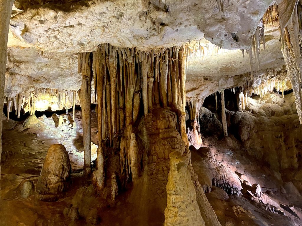
This is why the South East behaves so differently from the rest of the state. Where the mallee hardens and sheds rainfall, this country absorbs it. Where surface water elsewhere evaporates or flows to the sea, here it sinks downward, moving slowly through porous rock, surfacing only where the geology allows it to rise again.
The lakes throughout the region — from Blue Lake at Mount Gambier to the sinkholes, springs and wetlands spread across the plains — are not isolated bodies of water. They are visible parts of a much larger groundwater system, connected through the porous limestone and underlying aquifers that extend across much of the South East.
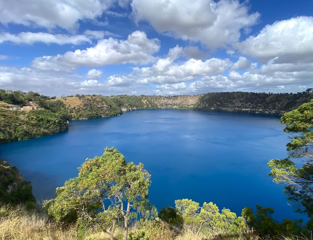
You can stand above the Blue Lake and observe its colour shift from steel grey in winter to cobalt blue in summer. The lake is one of the most visible expressions of the extensive groundwater system that sustains agriculture and communities across much of the South East. The water drawn for dairies, crops and plantations isn’t recent rain but ancient water filtered and stored through processes that began when this land was still part of the ocean floor.
Two agricultures, two logics
The difference between this country and the mallee goes beyond tangible things like rainfall or industry. For me, it’s about outlook.
In the mallee, as I mentioned in my earlier blog, farming faces restrictions. The soils are shallow, rainfall is unpredictable and the seasons are tough. Cropping systems there accept failure as normal and management focuses on survival rather than profit. Clearing was never gentle because the land itself left no room for hesitation.
In the South East, however, the situation is quite the opposite. Here, water forms a vital part of the landscape. Irrigated fodder crops support dairies that wouldn’t be possible in much of the rest of the state. Potatoes, lucerne, seed crops, vineyards and market gardens are cultivated on land that elsewhere in South Australia might be considered too wet, too cold, or too unpredictable.
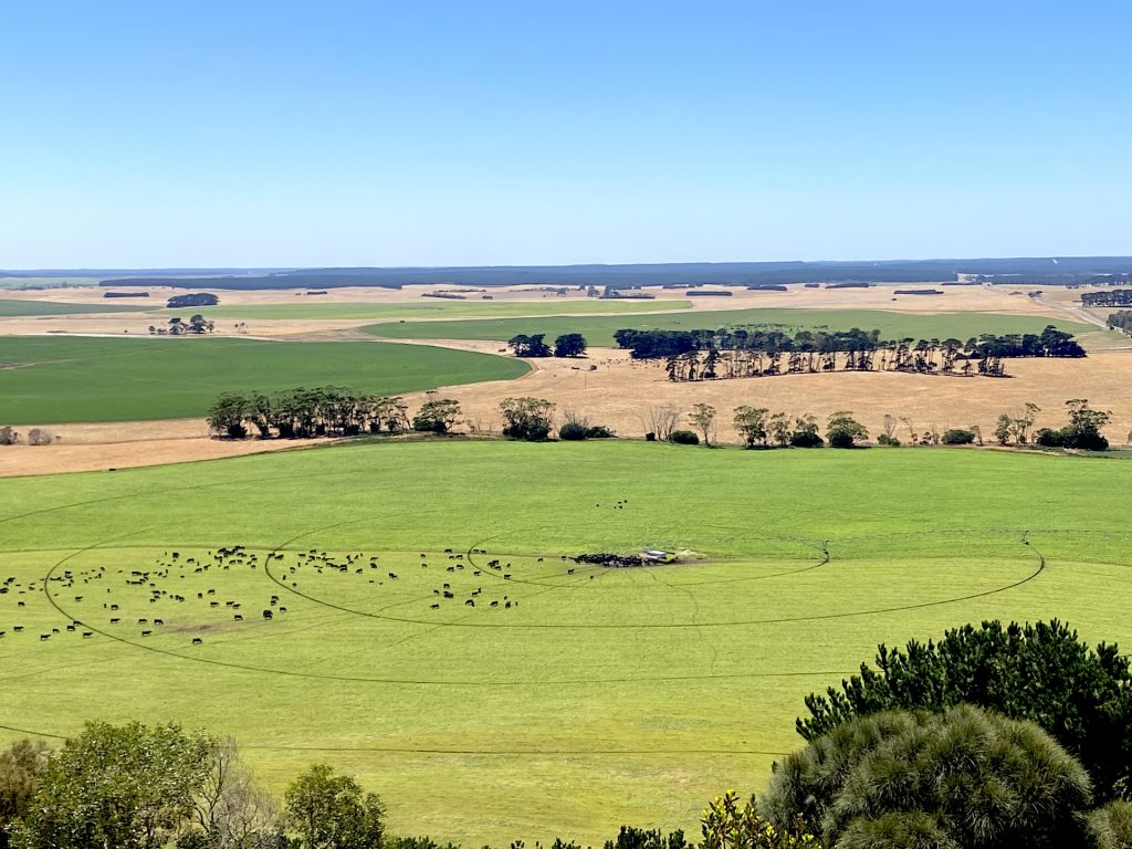
The land itself provides a buffer against failure. The aquifers beneath the limestone offer ecological security, allowing investment in long rotations, permanent pastures and efforts that sustain continuity.
Volcanoes and fractures in the plain
This limestone country bears the scars of a younger, more violent past. The South East is part of the Newer Volcanics Province, a volcanic belt that stretches across western Victoria into South Australia. Between four million and five thousand years ago, eruptions broke through the limestone crust, creating maars, cones and lava flows that still shape the landscape. Here are the country’s youngest volcanoes.
Mount Gambier, Mount Schank, Valley Lake and the Leg of Mutton Lake are not isolated features but part of a broader pattern of geological disturbance. Magma interacting with groundwater caused explosive eruptions that formed crater lakes, which are now fed by the same aquifer they once ruptured.
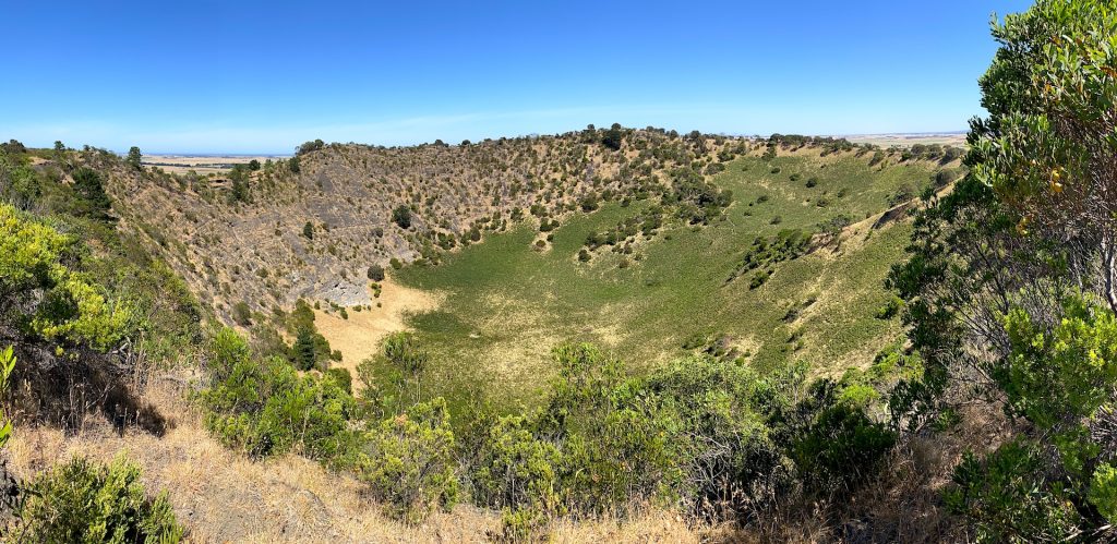
These volcanoes fractured the plain, creating pathways through which water still flows rather than forming mountains. They remind us that this is not a static agricultural region, but a dynamic landscape whose stability depends on processes that began long before European settlement.
Why forestry came south
South Australia was never a timber state in the way other states were. Its early industries were built on grass and grain rather than wood and by the middle of the nineteenth century, it was already clear that the colony’s scattered native forests could not supply the timber its growing towns, railways and mines demanded. At the same time, there was growing public anxiety about the pace of land clearing and the loss of remnant bushland, anxieties that were as much about climate as about conservation. Many genuinely believed that forests could “call down the rain,” that tree cover itself might soften the state’s harsh seasons and stabilise its water cycle.
Out of this mixture of shortage, optimism and environmental concern came the creation of the Forest Board in 1875, charged with protecting what remained of native forest and, just as importantly, experimenting with plantation forestry as a means of securing the state’s future timber supply. Trial plantings spread across the state and by the turn of the twentieth century, a small group of species had proven themselves commercially viable. They were radiata pine, maritime pine, sugar gum and Tasmanian blue gum. Of these, radiata pine gradually emerged as the preferred species because it responded well to South Australia’s soils and climate, produced a versatile timber and could be seasoned, treated and milled to meet a wide range of structural and industrial needs.
It did not take long, however, for planners to realise that plantations scattered across marginal country would never be enough. Demand was rising faster than trees could grow and the state was already importing large volumes of timber. Attention inevitably turned to the South East because it offered precisely what foresters required — reliable rainfall, deep, well-drained soils, secure groundwater, flat terrain and access to ports capable of moving large volumes of product.
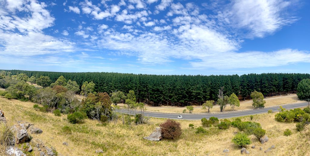
Here, plantations did not displace agriculture so much as settle alongside it, drawing on the same geological advantages that sustained dairying and irrigated cropping. By the middle of the twentieth century, tens of thousands of hectares of radiata pine had been established across the region and by the 1970s the South East — together with south-west Victoria — had become the core of what is now known as the Green Triangle, the most concentrated plantation forestry region in the nation. South Australia’s share alone approached 100,000 hectares, a scale that transformed the landscape and the regional economy.
Behind this expansion lay an increasingly sophisticated approach to tree breeding and silviculture. Nurseries were established in the Mount Lofty Ranges and the South East to raise local planting stock, initially in open ground without irrigation, which meant that drought years could sharply reduce seedling availability. Early seed collection focused on the best-performing trees in mature plantations, but from the 1960s, clonal seed orchards were developed to improve genetic quality and consistency. When these orchards were destroyed in the Ash Wednesday fires of 1983, their loss prompted a major collaborative effort between government and industry, leading to the formation of the Southern Tree Breeding Association and a shared program to rebuild seed resources for the entire region.
By the 1970s, however, a quieter problem had begun to emerge. After the first full plantation rotations were harvested and the sites replanted, it became clear that productivity on second rotations was declining. Growth rates declined, tree health suffered and yields dropped in ways that could not be explained by climate alone. Research revealed that the old practice of broad-scale slash burning, used to clear harvest residues, was stripping organic matter from the soil and degrading its structure. In response, burning was progressively abandoned and replaced with chopper-rolling to break down logging debris while retaining it on site. Large waste logs were removed where necessary, and in a fortunate alignment of markets and materials, this residue found a use in the emerging particleboard industry. Weed control was also refined, marking a shift away from brute force toward more ecologically informed management.
Then, in February 1983, the system was tested in the most brutal way possible. The Ash Wednesday fires swept through the Mount Lofty Ranges and the South East under extreme conditions, burning through Kuitpo and Mount Crawford near Adelaide, and through most of the Mount Burr and Penola forests in the South East. There, six separate fires merged after a violent south-westerly change, and the exposed eastern flank became a 50-kilometre wall of flame. In just six hours, more than 20,000 hectares of plantation were destroyed. Periodic flame bursts reached nearly 200 metres in height, creating firestorm conditions rarely witnessed in Australia’s forestry history.

What followed was a moment for action. If the burnt timber was not recovered quickly, it would rot. A salvage operation of unprecedented scale was mobilised. Logging contractors were brought in from interstate, mills ran around the clock and crews worked among still-smouldering stumps. Within six months, around 1.5 million cubic metres of timber had been salvaged. Local mills processed a third, while the remainder was stored to preserve its quality. More than half was submerged in Lake Bonney and the rest was held at above-ground sites under constant sprinklers to maintain anaerobic conditions. Remarkably, there was no significant loss of timber value during storage.
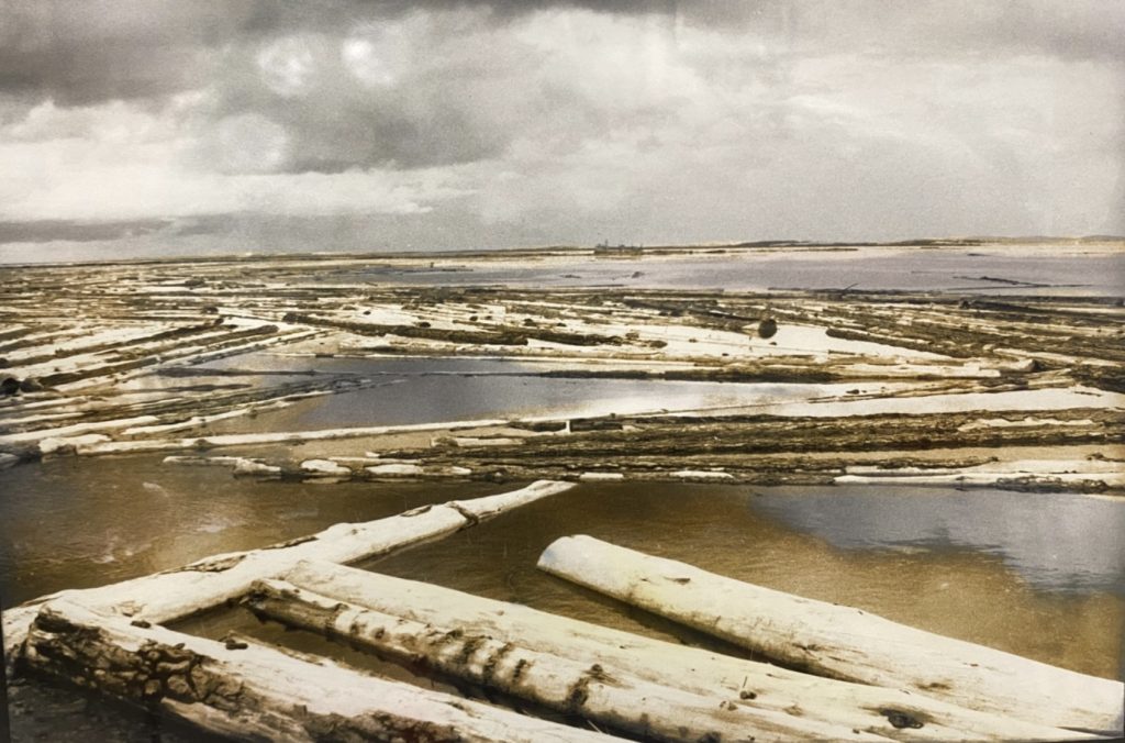
Out of that devastation came a new way of thinking about plantations as systems that had to coexist with fire. Every burnt hectare was replanted and by 1994, the estate had been fully restored. But it was not rebuilt as it had been. Following detailed reviews, a grid of fuel-modified protection zones was established, dividing the forest into large blocks of around 2,000 to 3,000 hectares. Within these zones, trees were pruned to reduce ladder fuels, strips were thinned and raised to six metres, and wide, strategically placed corridors were created along major roads. Fuel loads were actively managed with chopper rollers and heavy slashers, and rapid-response systems were introduced to automatically dispatch fire crews upon receiving a call.
The modern plantation landscape of the South East is the product of fire, failure, learning and adaptation — a working forest shaped by what the land, and the flames, have already taught.
For decades afterwards, plantation management returned to its familiar rhythm of planting, thinning, pruning, harvesting and replanting. Decisions were shaped by soil, rainfall, timber markets and fire risk, those same factors that had guided forestry for a century.
Then, gradually, another influence began to assert itself.
The carbon turn
It would be wrong to pretend that forestry had ever existed in a purely ecological vacuum. Plantation expansion has always followed the currents of economics and government policy as much as rainfall or soil. The early radiata pine programs were driven in part by employment schemes following the First World War. The great wave of blue gum planting in the early 2000s rode in on the back of Vision 2020 targets, tax-effective investment structures and a belief that plantations would relieve pressure on what were described as “over-harvested” native forests. Forestry, like farming, has never been immune to the fashions of the day. What has changed more recently is the nature of those fashions.
The rise of the carbon credit system introduced a new objective into plantation management, one not derived from silviculture or ecology, but from the accounting rules of emissions policy. Under the Australian Carbon Credit Unit scheme, plantations could earn credits for storing carbon, provided they met a series of integrity rules. Central among these was the concept of “additionality”.
In simple terms, additionality requires that the carbon stored by a project must be over and above what would have happened anyway under business-as-usual conditions. The credits are meant to represent a genuine, extra environmental benefit, not simply the continuation of existing practice. To enforce this, the scheme applies several overlapping tests. The activity must not be legally required and it must generally be new, not already underway at the time of project registration. And it must be unlikely to occur in the ordinary course of events without the incentive of carbon income.
On paper, this is presented as an integrity safeguard, a way to prevent greenwashing and ensure that credits correspond to real emissions reductions. In the abstract, the idea is not unreasonable. No one wants to pay for a carbon benefit that would have occurred anyway.
The difficulty arises because the scheme must distinguish between carbon storage generated by genuinely additional activity and carbon that would have been stored under business-as-usual forestry. The Plantation Forestry Method therefore creates eligibility around particular changes in land use or management — establishing new plantations, extending rotations, maintaining plantations that might otherwise be converted, or transitioning eligible plantations to permanent forest. Carbon income consequently becomes another factor in decisions that traditionally would have been governed principally by land capability, timber markets and silviculture.
The perverse incentive is subtle but real. Rather than rewarding the most efficient and sustainable forestry practices, the system rewards changes that qualify as additional under the scheme, thereby placing a financial value on management choices that may not coincide with the silvicultural optimum. The system can therefore favour forests that would not otherwise have been established, with eligibility determined by their additional carbon benefit rather than the quality, resilience or commercial value of the resulting timber crop.
Other requirements follow. Projects must be demonstrably new. Carbon must be maintained for decades — often 25 or 100 years — regardless of how markets, fire regimes, or regional economies evolve. Rotation lengths, harvesting schedules, species choices and land tenure arrangements all become entangled in compliance obligations that extend far beyond the normal planning horizons of forestry. The forest becomes, in effect, a financial instrument tied to a regulatory timeline.
None of these requirements emerged from forestry practice itself. They are products of legislation, modelling and economic theory outside of forestry. The emphasis shifts from cubic metres of timber to tonnes of carbon, from soil and growth rates to spreadsheets and compliance audits.
And as has happened in earlier policy cycles, management decisions begin to follow the incentives on offer. Where once plantations were designed primarily around timber quality, rotation length and fire resilience, there is now pressure in some cases to align decisions with carbon credit rules. Productive farmland may be converted to carbon plantings because it satisfies the additionality tests. Harvest schedules may be shaped by crediting periods rather than sawmill demand. Species choices may reflect carbon models rather than local markets.
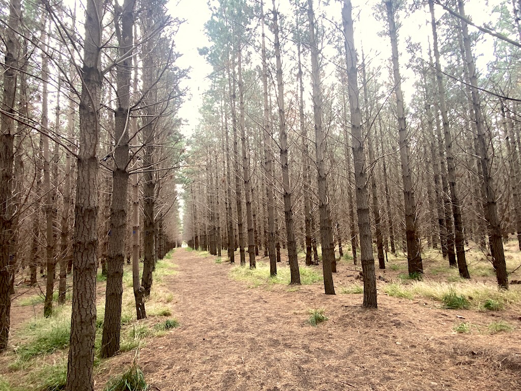
In that sense, carbon is simply the latest policy wave to wash over plantation forestry, following the employment schemes of the early twentieth century and the tax-driven expansions of the late twentieth. Each wave arrives with its own language, its own promises and its own incentives, and each leaves its mark on the landscape.
The difference this time is that the language is global, the timelines are longer and the accounting reaches further into the future. Carbon markets promise permanence in systems where fire, drought, pests and markets have always made permanence an illusion.
The irony, of course, is that native and plantation forests have always been one of the most effective carbon sinks available. For more than a century, foresters have managed trees that absorbed carbon, produced renewable materials, replaced more energy-intensive products and sustained regional communities. None of that required additionality tests or permanence contracts. It required rainfall, soil and people willing to regenerate or plant trees for the long term.
The risk now is not that carbon becomes part of forestry — it always has been — but that forestry becomes subordinate to carbon accounting, its decisions shaped less by the land and more by the rules of a financial instrument designed far from the paddocks and plantations where the consequences are felt.
A quiet truth about the South East
The South East does not fit comfortably into South Australia’s narratives of scarcity and struggle. It is neither heroic nor desolate, neither iconic nor easily simplified. Nor does it really lend itself to slogans.
But it holds what the rest of the state depends on — water, food, timber and a reminder that landscapes are saved by understanding what lies beneath them, not by ideological beliefs.
From the mallee’s dust to the Barossa’s vines, from the fire-prone hills to the contested lakes, I found South Australia tells many stories. Here, in the South East, those stories converge in a landscape shaped first by the sea, then by farmers, foresters and fire, and now by the abstractions of carbon accounting.
Beneath the paddocks lie the remains of an ancient ocean. Above them, a working landscape persists and in that quiet persistence lies the reason this country endures.