It is always good to get the opportunity to visit a historic site that represents the area you are visiting. In this case, I am talking not about an old building or monument in town but a sizeable pastoral station in the Outback.
Bladensburg was one of the original stations in the Winton district, grazing thousands of sheep and around one thousand cattle. It is located about 15 kilometres outside of Winton.
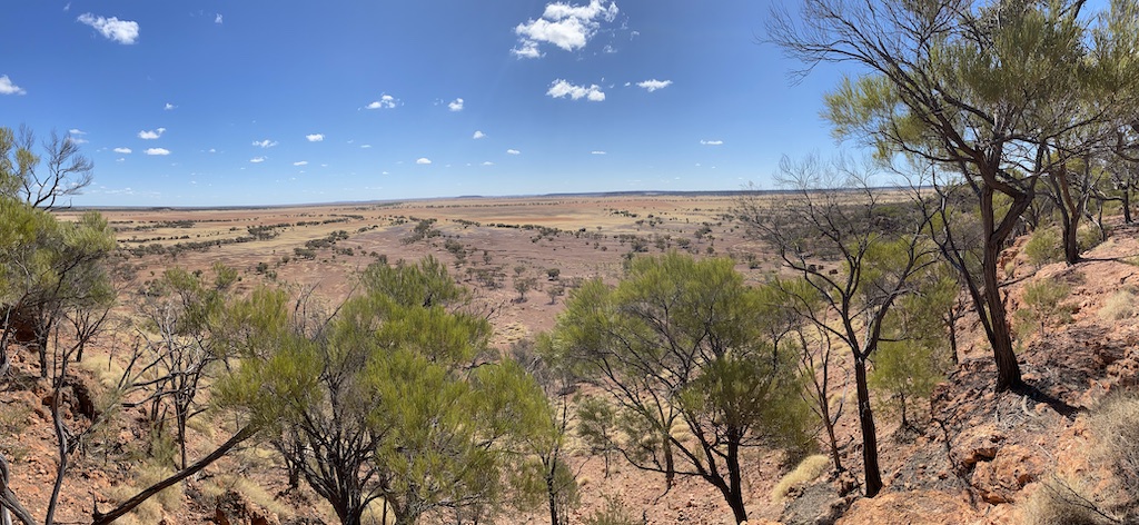
Bladensburg is situated on fertile black clay soil that supports vast Mitchell grass plains (Astrebla spp). A lack of tree cover characterises the Mitchell grass country.[1] Still, I did see a lot of belts of lancewood (Acacia shirleyi), as well as gidgee (Acacia cambagei) scattered throughout our drive through the station.
Mitchell grasses are tolerant of heavy grazing and are renowned for their capacity to respond well following heavy grazing, provided summer rainfall is reasonable. One intriguing factor is that high animal productivity from these pastures derives from the ephemeral grasses (Mitchell grass is perennial) and forb species that grow after rainfall. Mitchell grass provides bulk drying during the dry non-growing winter season. But there is no doubt that changes have occurred on these plains from the pastoral industry. The main impact has been the spread of the exotic prickly acacia (Acacia nilotica) which was first introduced as a fodder tree. Prickly acacia essentially transforms the previously treeless grasslands into savannas with clumps of wattle.
A study by University of Queensland Professor and plant ecologist Rod Fensham and colleagues in 2000 showed that sheep and cattle grazing had a weak yet detrimental effect on the Mitchell grass plains’ community composition.[2] Fensham believes that the shrub invasion, which has exacerbated this process to favour trees over grass, is not a result of removing traditional Aboriginal burning practices or CO2 fertilisation. Fensham maintained what he called an open mind when he studied the shrub invasion. Rather than using models or physiological predictions, which climate scientists and ecological academics rely on these days, he treated the story as a hypothesis that required testing based on history and the evidence he encountered in the bush.[3] His work led him to look at regional surveys and long-term monitoring. He decoded the records of explorers and surveyors and deciphered the archive of aerial photography and beyond. He is convinced that the real force driving the outback landscapes was not humans, herbivore or fire, but the notorious Australian ‘drought and flooding rains’ – the boom and bust conditions that so many animals and plants are adapted to in the Outback. It certainly questions the status quo that lays the blame for the ecological problems in the Outback on the pastoral industry.
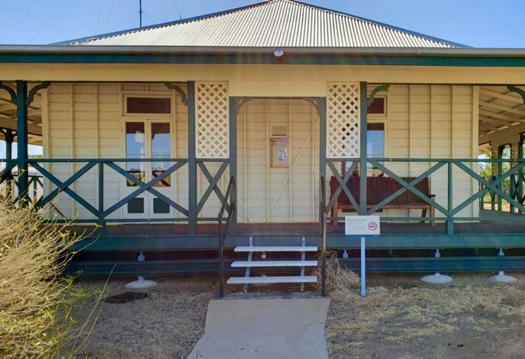
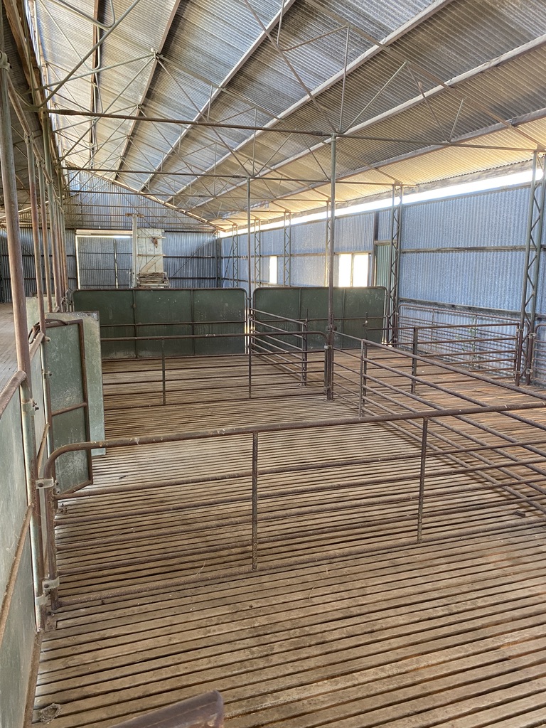
Bladensburg is now a National Park covering 85,000 hectares, dedicated in 1994. The homestead is used as an information centre and ranger base. You can walk into and around the old homestead and see photos that show the station at its peak. There is also information about early station life. In fact, in the early 1900s, it is believed the homestead was moved from Charters Towers to its current location. The original old hut became the blacksmith shop. There is a woolshed nearby that was built in 1925. Before then, they took their sheep to Winton for shearing.
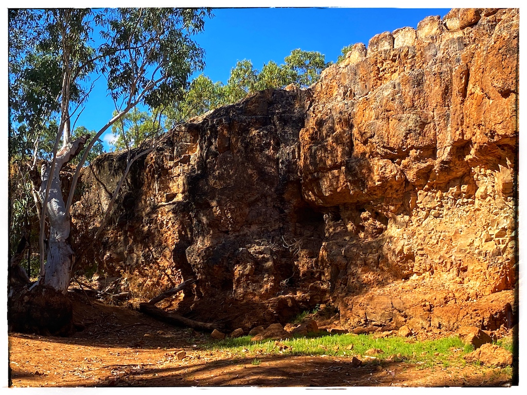
An interesting place to visit is Scrammy Gorge.
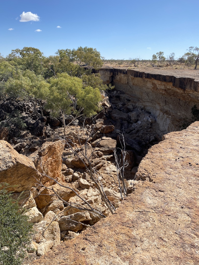
During rain periods, water flows down crevices in the rock and over time, the cracks have widened. Erosion of the sandstone beneath harder caprock has occurred over millennia until, eventually, large blocks have tumbled into the gorge. We see it today.
Part of the tourist drive takes you up onto a mesa[4] to Scrammy Lookout[5] with a beautiful view looking back towards Winton over the Mitchell grass plains. There are mesas over varying heights scattered throughout the park. This lookout would be a great place to watch the sunset.
Has anyone got a sunset photo from this spot?
[1] For more about the Mitchell grass plains see my blog https://www.robertonfray.com/2020/11/06/woody-weed-invasion-of-the-rangelands/
[2] Fensham, R. et al (2000) Broad-scale environmental relations of floristic gradients in the Mitchell grasslands of Queensland. Australian Journal of Botany 48(1):27-38
[3] My type of academic, one that knows what he is talking about using the proper scientific method!
[4] A mesa is a flat-topped mountain or hill with steep sides and stands distinctly above a surrounding plain. They usually consist of compressed layers of sedimentary rock with a top layer of harder rock that is resistant to erosion.
[5] Scrammy Gorge and Lookout are named after Scrammy Jack who was a boundary rider. Scrammy is an old English term for someone who was left-handed. Apparently Scrammy Jack injured his right hand at a younger age when it was run over by a large wagon wheel.
Thank you Robert.
Understanding the effects of Aboriginal burning and the impacts of its disruption, requires an appreciation of history, fire behaviour, nutrient cycling, ecology and silviculture. That is, “The Big Picture”. Leichardt’s observations in Queensland as well as Mitchell’s were made after Aboriginal burning had been substantially disrupted by the smallpox epidemic which swept down from Torres Straight in 1789.
Two extracts from Firestick Ecology:
Fensham and Fairfax found no association between grassy balds and environment, but they didn’t construct a hypothesis and design an experiment to test it. Instead they jumped straight into data collection and statistical analysis.[68] The balds were made where eucalypt woodlands grew, and woodlands grew where fire could run freely. Their coarse categorisations of slope and aspect missed the subtle interactions underlying flammability. Even so, their data showed that there were nearly twice as many balds on dry, northerly and westerly aspects compared to more sheltered, easterly and southerly aspects. The larger balds were on steeper slopes[69] because fire runs faster and further up steep slopes.
Gammage’s picture of a bald illustrates some of the subtleties. Rainforest grows on steep, sheltered, easterly slopes; grass and eucalypts grow on more exposed, gentle, upper slopes. He suggested that:
“It is not easy to burn rainforest to make grass, or to keep back eucalypts and other fire friendly species while protecting fire sensitive bunyas. To do all these at once evidences expert botanists and fire managers over many generations”.[70]
But it’s not really that complicated. Aborigines burnt grasslands and woodlands when hunting wallabies, and lit campfires in the hollow butts of widely spaced red gums whilst they gathered and feasted on bunya nuts. These fires prevented eucalypts from invading grasslands and converted some woodlands to grasslands when all the red gums eventually burnt down. Aboriginal fires trickled across grassy flats and down gentle upper slopes killing new seedlings. They raced up steep exposed slopes, but they couldn’t run on steep sheltered slopes where rainforests lived.
Ludwig Leichardt described a similar situation near the Hunter Valley in 1843:
“The base of both mountains is covered with forest, the principle tree being the black butt. The westerly flancs are covered with a rich grass, devoid of trees at Piri and with very few ones at Mt. Royal. The easterly flancs are covered with a rich brush to the even edge of both mountains”.[71]
[68],[69] Fensham, R.J., Fairfax, R.J. 1996 “The disappearing grassy balds of the Bunya Mountains south-eastern Queensland”. Australian Journal of Botany 44, 543-58.
[70] Gammage 2011, p. 71-2. Gammage, B. 2011 The biggest estate on earth: how Aborigines made Australia. Allen & Unwin, Sydney.
[71] Leichardt 1843. Leichardt, F.W.L. 1843 Letter to Lt. Robert Lynd 19 February. In The Letters of F.W. Leichardt Volume II. Cambridge University Press. pp. 632-3.
Brigalow is very drought tolerant. Mitchell saw that mass mortalities had occurred in dense scrubs of brigalow, but not in “forest land”. He didn’t see shifting boundaries between trees and grass according to sustained drought or waterlogging as he did in other regions. Drought deaths are common in the post-European forests that replaced drought-resistant open woodlands when Aboriginal burning was disrupted.
Certainly smallpox would have been more virulent near the tropics and would have become less deadly as it moved south through the Aboriginal population, spread by ‘carriers’ who survived infection.[8] Even so, Curr described trees and scrubs that grew up after local tribes were decimated by a smallpox epidemic on the Murray.[9] In northeastern Tasmania, Robinson saw “dense overgrown underwood” that had invaded woodlands after Aborigines were decimated by influenza.[10] Gammage suggested that “At the risk of their souls, people cared for every inch of their country, even after smallpox halved their numbers and management capacity”.[11] Mitchell’s, Robinson’s and Curr’s observations show that this was not the case.
[8],[10] Flood, J. 2006 The Original Australians: story of the Aboriginal people. Allen & Unwin.
[9] Curr, E.M. 1883 Recollections of Squatting in Victoria, Then Called the Port Phillip District, from 1841 to 1851. Facsimile Edition 1968. George Robertson/Libraries Board of South Australia, Melbourne/Adelaide.
[11] Gammage 2011.
https://www.connorcourtpublishing.com.au/Firestick-Ecology-Fairdinkum-Science-in-Plain-English_p_41.html
Thanks Vic. You have certainly outlined why this whole issue is so much more complicated than the simplistic and flawed version of ecology portrayed by bureaucrats and ideologically driven academics. Their sole aim is to implement government policies principally aimed at curtailing the practices of industries such as pastoralism and forestry.