A summer journey of sea, grain and surprises

After seven months in Western Australia and crossing the vast emptiness of the Nullarbor, we looked forward to finally exploring the Eyre Peninsula during our travels around Australia. On the map, it seemed a remote corner of South Australia, jutting into the Southern Ocean between Spencer Gulf and the Great Australian Bight. In reality, we discovered one of Australia’s most fascinating regions, where spectacular coastlines, productive farmland and welcoming seaside towns combine to create an unforgettable destination.

We arrived in the middle of summer, when the peninsula was at its liveliest. Holidaymakers had flocked to the coast, caravans filled the parks and jetties and children were irresistibly drawn to the water despite the surprisingly cool temperatures.

For a couple of weeks, we moved our caravan between the coast and the inland farming districts. It was the perfect way to appreciate the peninsula, because neither landscape can be fully understood without the other.

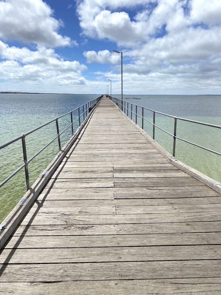
Streaky Bay jetty.

Our first base was Streaky Bay. The town sits quietly beside calm blue waters, but beyond its sheltered bay lies one of Australia’s most dramatic coastlines. We spent our days exploring from Cape Bauer to Point Westall, where towering limestone cliffs have been sculpted by the Southern Ocean over countless centuries.

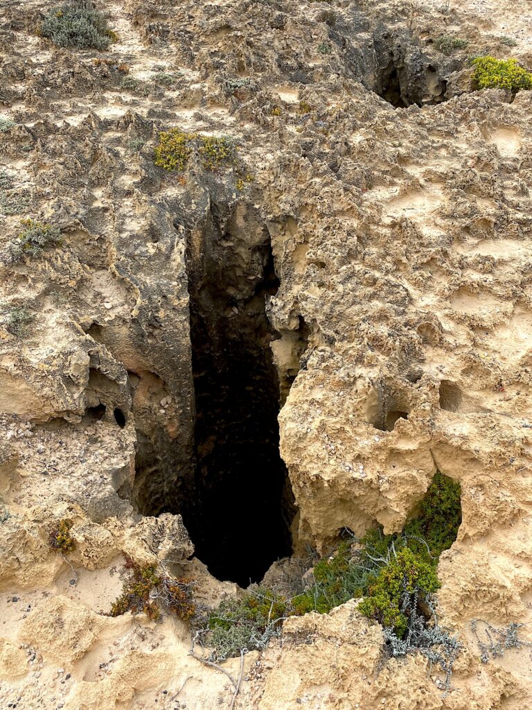
The Whistling Rocks and the blowholes were particularly fascinating. Deep fractures in the limestone have gradually widened under the relentless force of wind and waves. At certain times, compressed air is forced through narrow openings, producing a haunting whistle, while nearby blowholes erupt with seawater propelled upward by the power of the ocean below.

Whistling Rock.
Blow holes.

We briefly considered staying at the iconic Perlubie Beach, but summer crowds had well and truly descended. Caravans lined the sand, campers crowded around the beach huts and piles of seaweed covered much of the shoreline. It lacked the appeal we had imagined and reinforced one of the joys of travelling with a caravan — you simply move on until you find somewhere that suits.

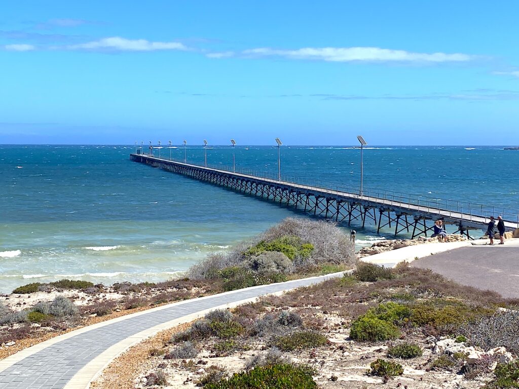
Our next stop was Elliston on the west coast. With a permanent population of only about 400 people, it transforms in summer as visitors arrive to fish, swim, surf and explore the rugged surroundings. The magnificent 427-metre jetty dominates the waterfront. Heritage-listed today, the jetty’s steel pylons were screwed into the seabed using a horse-drawn winch in 1900, a remarkable feat of engineering for such a small and isolated settlement.

Elliston proved an excellent base for exploring Waterloo Bay and the nearby coastline. The bay’s narrow entrance, formed by reefs projecting from the headlands, made it notorious among mariners. Ocean swells rolling in from the Southern Ocean often made anchorage dangerous, and over the years, many vessels have been wrecked or driven ashore along this unforgiving coast. Even in perfect summer weather, the sea retained an air of menace.

Elliston jetty.

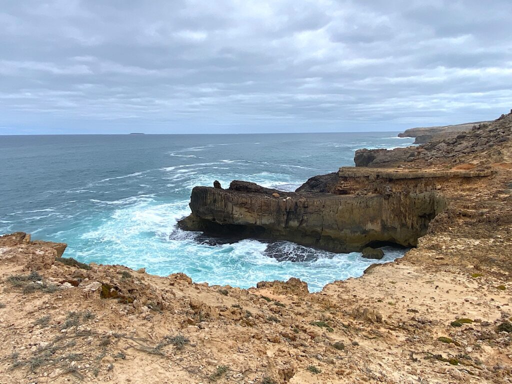
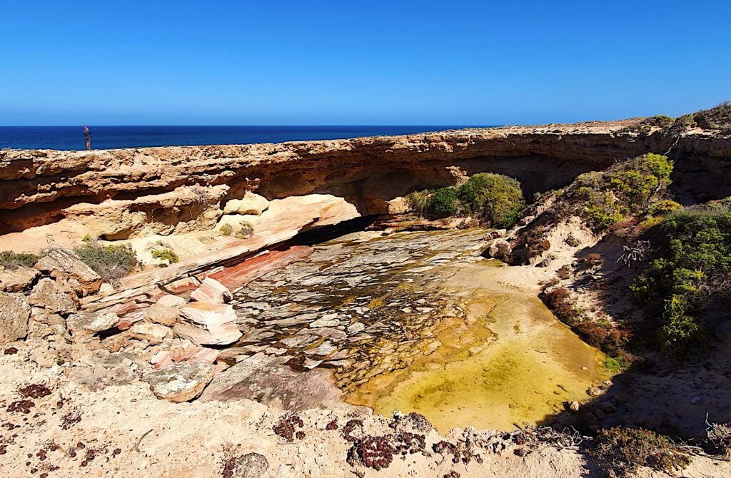
Driving north from Elliston brought us to Cape Finniss, the Tub and the Talia Caves. This is wild country where heavy swells pound the cliffs with enormous force. At the Tub, the ocean has exploited natural weaknesses in the sandstone and limestone, eventually causing the cave roof to collapse and leaving a spectacular bowl-shaped depression some 60 to 70 metres deep. Standing there, looking down into this immense geological feature as waves thundered nearby, was one of those moments that simply cannot be captured in photographs.

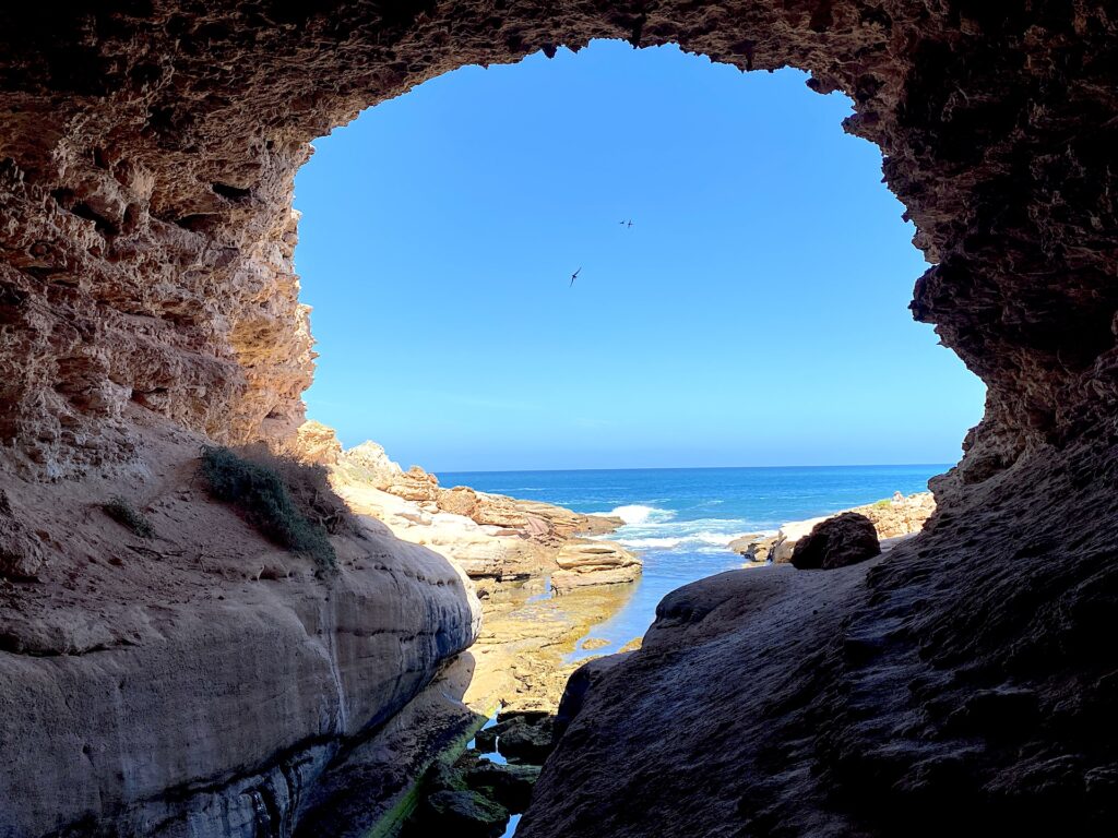
Tahlia Cave.
The Tub.

The rich waters off this coastline support valuable fisheries, particularly Southern rock lobster, snapper and the highly prized King George whiting. Fishing is almost a way of life on the Eyre Peninsula. Every town has its favourite jetty or secret beach. At Haslam, locals assured us we would catch squid in half an hour, and they were not far wrong. At Tumby Bay, fish-cleaning stations are thoughtfully positioned beside the jetty. At Lock’s Well, serious anglers willingly descend 283 steps to the beach in pursuit of salmon.

Even if you never cast a line, there is something quintessentially Australian about watching fishermen on a jetty as the evening light fades.

Eventually, we moved inland to historic Cummins, right in the heart of the grain country. The contrast with the coast was extraordinary. The rocky headlands and crashing waves were gone. Instead, vast paddocks stretched towards the horizon, grain silos dominated the skyline and enormous machinery stood ready for harvest.

Cummins is an important service centre for surrounding farming communities. The old railway triangle has been converted into a park and picnic area, while the town’s public toilets gained unexpected fame in 2018 by winning an International Toilet Tourism Award for their mosaic-style artwork.

The district is also home to Cummins Milling, one of Australia’s oldest flour mills and the only one on the Eyre Peninsula. Here, the realities of farming become more apparent. Rainfall is unpredictable and farming families work in a landscape that can be both productive and unforgiving, but these communities have endured through generations of resilience and hard work.

One of the more unusual sights was the famous “tree with a difference”, decorated with hundreds of shoes, boots and sandals, which appeared after the devastating 2005 bushfires. Like much of the peninsula, it tells a story of community and recovery.

One of the highlights of our time on the Eyre Peninsula was Coffin Bay. The peninsula proudly boasts its fishing credentials, and many towns lay claim to excellent oysters, but for true oyster aficionados, there is only one destination.

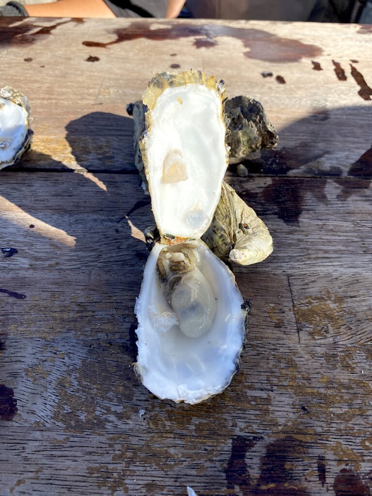
Freshly shucked oyster.

Coffin Bay is a unique coastal system comprising a series of sheltered bays, protected by the Coffin Bay Peninsula as it extends into the Great Australian Bight. The geography has created near-perfect conditions for oyster farming. The Leeuwin Current brings nutrient-rich water into the Great Australian Bight, carrying plankton that oysters feed on. The bay’s narrow entrance and a natural sandbar act as a giant trap, drawing plankton into the sheltered waters, where they remain available as a constant food source. The result is oysters renowned for their sweetness and exceptional flavour.

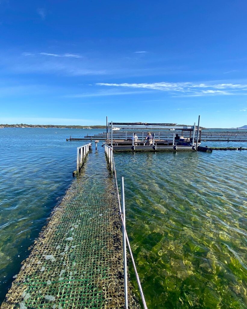
Rather than simply eating oysters in a restaurant, I decided to experience the industry firsthand. Pulling on waterproof waders, I followed oyster farmer Ben through the crystal-clear water, carefully stepping around small stingrays, to the semi-submerged saltwater pavilion, which sits directly on a commercial oyster lease. It proved to be one of the most enjoyable experiences of our trip.

The semi-submerged saltwater pavilion.

I learned that oysters are hermaphrodites, that each oyster filters about eight litres of water a day and that Coffin Bay oysters can reach Hong Kong before they make it to Melbourne. I even tried our hand at shucking oysters. Best of all, I tasted them straight from the water. It is hard to imagine a fresher or more authentic culinary experience.

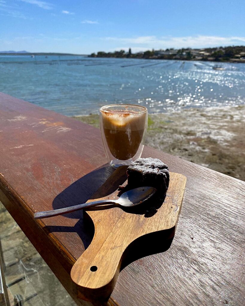
Afterwards, we finished our visit with the Oyster Walk along the foreshore to Crinoline Bay and Kellidie Lookout, then sat quietly with a coffee and a chocolate brownie, overlooking the oyster leases.

Coffee and brownie overlooking Coffin Bay oyster leases.

Eventually, our travels brought us to Port Lincoln, Australia’s undisputed seafood capital. The town is home to one of the world’s great natural harbours, Boston Bay, and the waterfront is alive with fishing vessels, pleasure craft and people simply enjoying life by the sea.

We spent an enjoyable afternoon wandering around the harbour, watching the commercial fishing fleet. Port Lincoln claims to produce some of the cleanest and most sought-after seafood in the world and with the boats tied up beside the wharves, it was easy to believe.

The city’s fishing and aquaculture industries are remarkably diverse. Southern bluefin tuna, hiramasa kingfish, snapper and King George whiting all thrive in the clear waters around the peninsula. Spencer Gulf king prawns, southern rock lobsters, mussels and abalone regularly appear on menus at some of the world’s finest restaurants.

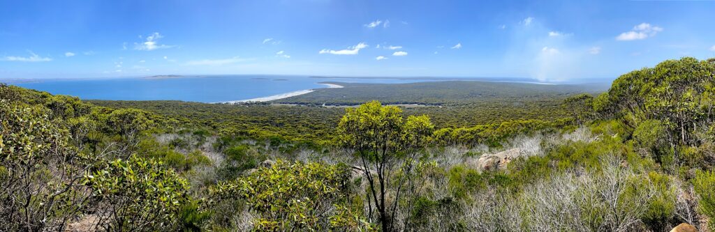
View from Stamford Hill in Lincoln National Park.
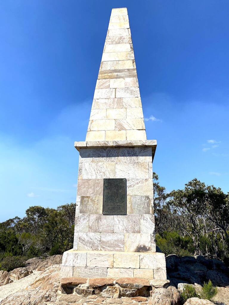
Matthew Flinders monument.

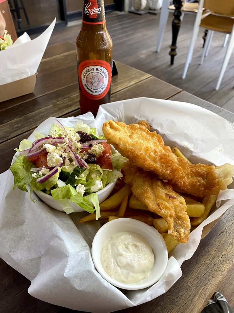
Of course, no visit to Port Lincoln would be complete without fish and chips and an ice-cold Coopers. After an enjoyable walk through Lincoln National Park, including the climb to Stamford Hill and the Matthew Flinders Monument, we settled in for a seafood lunch at the award-winning Fresh Fish Place. Sitting there with fresh King George whiting, chips and a South Australian beer felt like the perfect reward.

Fish and chips at Port Lincoln.

Back in town, children repeatedly leapt into the water at the Lido. Despite it being summer, the water remained remarkably cool, but that did not deter them. Their shrieks and laughter echoed across the harbour as parents watched from the shade. It perfectly captured the relaxed atmosphere of Port Lincoln.

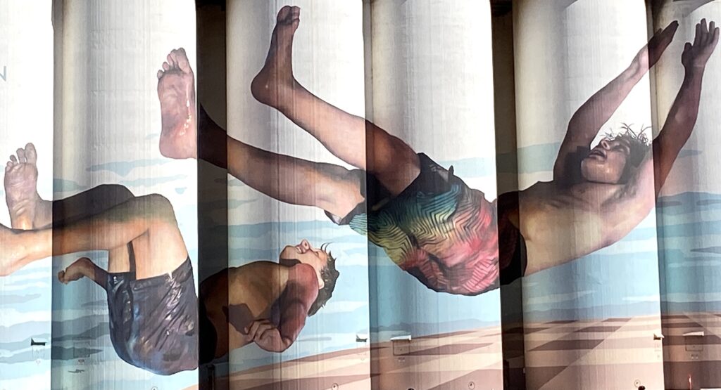
Further north, we visited beautiful Tumby Bay, one of the peninsula’s most attractive coastal towns. Crystal-blue waters, Norfolk Pines lining the foreshore and a peaceful atmosphere make it an idyllic destination. We happened to visit during the Colour Tumby Street Art Festival, when vibrant murals transformed walls across the town into an open-air gallery.

Mural at Tumby Bay.

Our last stop was Whyalla, which proved to be one of the peninsula’s surprises. As South Australia’s third-largest city after Adelaide and Mount Gambier, Whyalla has a very different character from the smaller fishing towns scattered across the Eyre Peninsula. It has long been associated with steelmaking, shipbuilding and mining and before arriving, we perhaps unfairly imagined it would be little more than an industrial centre.

How wrong we were. Nestled on the shores of the upper Spencer Gulf, Whyalla enjoys a wonderful coastal setting. Beautiful beaches fringe the shoreline, the foreshore is exceptionally well maintained and the relaxed atmosphere immediately appealed to us.

We stayed at the Whyalla Discovery Foreshore Caravan Park, perfectly positioned just a short stroll from the town’s impressive circular jetty. Unlike traditional jetties that simply extend into deeper water, Whyalla’s jetty loops back on itself in a giant circle, providing plenty of room for both anglers and walkers. Standing there in the evening light, looking back towards the city and across the gulf waters, it was hard to reconcile this peaceful setting with Whyalla’s heavy industrial reputation.

The city owes its existence largely to iron ore. Nearby deposits at Iron Knob and Iron Monarch were among the highest-quality iron ore resources in Australia, with ore purity exceeding 60 per cent. Mining began in the early twentieth century, and from 1903, iron ore was exported from Whyalla’s port. The ore initially supplied the steel industries of Newcastle and Port Kembla before steel production itself was established at Whyalla in the late 1930s. The mines ceased production in 1998, but their legacy remains deeply embedded in the city’s identity.

Whyalla’s industrial history also includes shipbuilding. During the Second World War, the town’s shipyard became an important contributor to Australia’s war effort. The rapid expansion of ship production in the early 1940s required the installation of a massive 150-ton fitting-out crane, another testament to Australia’s remarkable wartime manufacturing capability.

HMAS Whyalla.

It is easy to forget today how complex shipbuilding was. Every vessel progressed through numerous stages, from initial contracts and design drawings to ordering materials, machine-shop fabrication, assembly, machinery installation and final commissioning. Thousands of workers contributed their skills to produce ships urgently needed for the war.

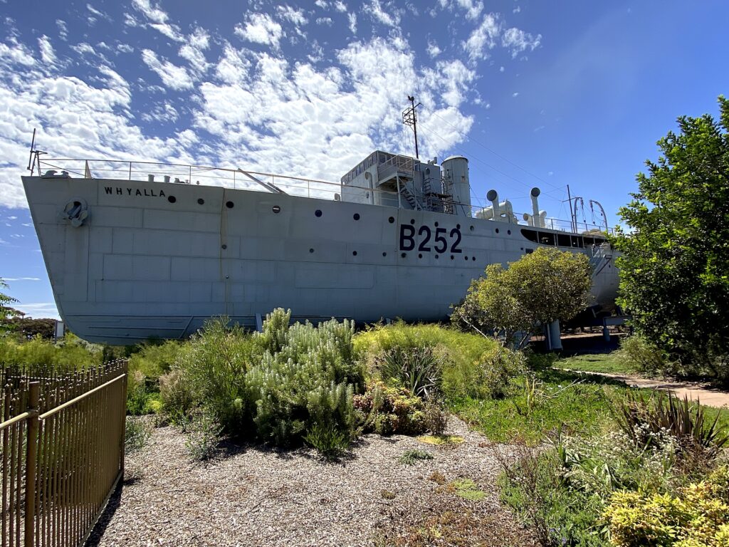
The highlight of our stay was undoubtedly the Whyalla Maritime Museum and Visitor Centre. Calling it simply a museum hardly does it justice. The centre celebrates the city’s rich shipbuilding heritage, and its centrepiece is the former HMAS Whyalla, the first ship built at the Whyalla shipyards.

Constructed in just nine months, from July 1940 to May 1941, she served with distinction during the war. In 1943, she became the first warship to survey the south-eastern coast of Papua New Guinea, conducting critical work around Milne Bay and Buna while Japanese forces remained in the region. The information gathered by the vessel helped open sea routes that were later used in Allied operations further north.

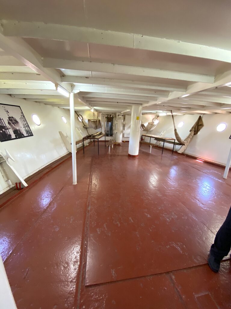
Inside HMAS Whyalla.

Throughout her wartime service, HMAS Whyalla undertook minesweeping, escort duties, survey work and troop transport. She steamed more than 110,000 miles during the conflict and carried a formidable armament, including a four-inch gun, anti-aircraft weapons and depth charges.

After decommissioning in 1947, she entered civilian service as SS Rip, working in Victorian waters, maintaining navigational markers and assisting with blasting dangerous sections of water at the entrance to Port Phillip Bay.

Today, she occupies perhaps the most unusual berth imaginable. The old warship now sits high and dry in beautifully landscaped gardens beside the Lincoln Highway, nearly two kilometres from the sea and two metres above the ground. Access is by guided tour only and stepping aboard offers a fascinating glimpse into the cramped, demanding conditions sailors endured during the Second World War.

Whyalla’s appeal extends beyond industry and history. The surrounding waters host one of the world’s most extraordinary natural events. Each year, between May and August, giant Australian cuttlefish gather in their thousands along the nearby coastline to breed. It is the only place on Earth where these remarkable “chameleons of the sea” congregate en masse. Local operators even offer opportunities to swim among them, an experience that has firmly placed Whyalla on the bucket lists of divers and underwater photographers from around the world.

Like much of the Eyre Peninsula, Whyalla continually defied our expectations. It is a place where steelworks stand beside tranquil beaches, where wartime history meets remarkable marine life and where an industrial city somehow retains an inviting coastal ambience. It was another reminder that the Eyre Peninsula is full of surprises, and that some of its greatest attractions are often found where you least expect them.

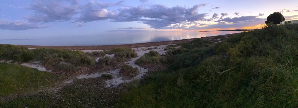
Sunset over Whyalla.

By the time we packed up the caravan and prepared to leave, we realised the Eyre Peninsula had quietly become one of the highlights of our journey around Australia. Few places offer so many experiences in one destination. Windswept bays and rugged cliffs, historic jetties and fishing villages, working grain farms and prosperous seafood industries, national parks and seaside esplanades, fresh oysters, fish and chips and an ice-cold Coopers overlooking one of Australia’s great natural harbours.

For first-time visitors, the Eyre Peninsula is full of surprises. It is a place where the sea and the land have shaped resilient, welcoming communities, and where every bend in the road seems to reveal another beautiful bay, another fascinating story and another reason to stay just a little longer.

1 thought on “A summer journey of sea, grain and surprises”

  1. A great open part of Australia little visited except by locals . Hope it stays that way Robert. First forayed there in the mid 60s chasing mallee whip birds and much else of natural interest among the sand dunes and limestone cliffs. Now have family living at Cowell so plan to attack those oysters just once more. Thanks for pressing a few buttons.

Leave a Comment

Your email address will not be published. Required fields are marked *