
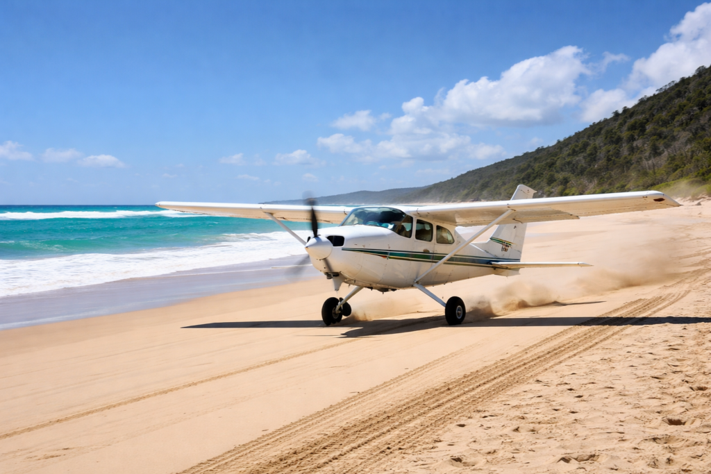
There is a long stretch of beach on the eastern side of Fraser Island where, at low tide, the sand hardens into something that eerily resembles a runway. It is straight and wide, and from above it looks almost intentionally designed, as if nature itself had foreseen the arrival of aeroplanes and laid out a landing strip accordingly. For nearly a century, pilots have looked down on this expanse and reached the same conclusion that if anything goes wrong, this is a place where you can land an aircraft.
However, the history of aviation on Fraser Island reveals a more complex story. For every successful landing, there is another that went wrong, not always dramatically, not always resulting in loss of life, but often enough to leave a quiet trail of damaged aircraft, near misses and hard lessons learned where sand, wind and sea meet. When assembled, these fragments do not form a catalogue of disasters but rather a more subtle picture of an environment that, while it welcomes aviation, also challenges it, sometimes gently, sometimes not.
The aeroplane comes to Fraser
The idea of flying to Fraser Island has been around almost since aviation became practical. As early as February 1936, reports indicated that the tourist resort at Happy Valley was negotiating with aircraft operators to ferry visitors directly to the island. The successful landing of one plane on the beach had, it was said,
Definitely established the fact that safe landings may be made on this beautiful stretch of sand.
The prospect was raised that travellers might soon choose between arriving by boat or by air.
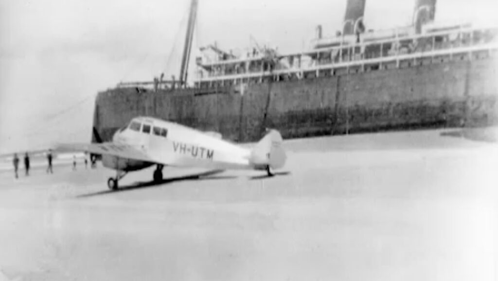
It’s a revealing moment. The beach, which for thousands of years had been shaped only by tides and winds, was already being reimagined as an airstrip without survey pegs, drainage, or grading, but with the apparent benefits of length and openness. That same optimism extended to other ideas.
In 1939, as war approached, it was suggested that the island’s lakes might serve as seaplane bases, inspired by Scottish lochs. Lake McKenzie, it was claimed, offered half a mile of potential runway across its surface. The idea didn’t progress further, but it shows how naturally Fraser Island’s geography suited aviation concepts.
By then, aircraft were already part of the island’s practical reality. They were used for reconnaissance, communication, and, increasingly, transport. The long beaches that had once acted as barriers became corridors, and the island, far from being isolated, was drawn into the expanding network of coastal aviation.
War, training and the emergency runway
The Second World War strengthened that link. Training flights from bases like Evans Head stretched along the coast, with Fraser Island directly under those routes. Among the aircraft most often seen were Avro Ansons, twin-engine trainers whose crews practised navigation over long coastal legs, where the margin for error was often tight.
On 7 November 1943, one of these aircraft was forced to land on Fraser Island, about a mile and a half south of Indian Head. The result was that the aircraft was safely brought down, with no loss of life. On board were three crew – pilot Bob Strand from Victoria, navigator John Barlow from Nanango and wireless air gunner Ian Templeton from Victoria. They were part of 74th Squadron RAAF at Lowood, west of Brisbane.
The plane they were flying was made of wood and fabric on a planned four-hour patrol to escort a ship in case of a submarine attack. During the first hour, they saw a storm building up. In the next hour, they lost sight of the ship due to a squall. All other aircraft on patrol were recalled except this one.
A sudden, violent gust of wind forced the plane into a 200-mile-per-hour dive, exceeding its maximum speed limit. The pilot was unable to level out until only 500 feet from the sea. They attempted to fly south to Evans Head to avoid the storm, but it was worse.
The dive had made the horizontal and compass instruments useless. Luckily, the ASDIC, a forerunner of radar, was used to locate the coast, which was said to be 30 miles away. It was just on dark when they flew over a white strip that was Seventy Five Mile Beach on Fraser Island. To the north, they saw the Sandy Cape Lighthouse beam flash and, with fuel tanks empty, crash-landed on the beach after dropping a flare.
The three crew members spent a cold night wrapped in their parachutes for warmth under the deflated rubber dinghy. They were rescued by a lifeboat from the troopship Wondana, en route to Townsville and flown back to their base three days later.
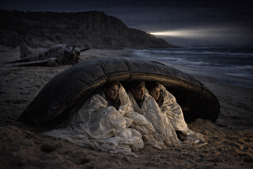
Afterwards, the engines and instruments were removed, leaving only the stripped airframe exposed to the elements—a skeletal reminder of the incident that persisted for years afterwards above the high water mark.
This was Fraser Island in its most forgiving guise. The beach, under the right conditions, could indeed serve as an emergency runway. But even then, the success of such a landing relied on timing, surface conditions and the pilot’s skill. It was never guaranteed, nor was it ever consistent.
Disappearances, boggy ground and a sudden descent
In the years following the war, as civil aviation grew, Fraser Island’s beaches and informal landing areas were used more often by light aircraft. This period marks the beginning of more revealing incidents, not necessarily dramatic crashes, but events that expose the island’s underlying hazards.
In late April 1963, a small aircraft carrying Albert Ernest Brooks and his wife Annie vanished during a flight from Bundaberg. The search spanned the sea north of Fraser Island and along its western coast, highlighting the uncertainties of coastal navigation and the challenges of finding a missing aircraft in such waters. The fate of that flight remains part of the larger, unresolved history of aviation along this coast.
The following year, on 15 May 1964, a more grounded but equally instructive incident took place. A Cessna 184, carrying timber faller Roy Fish, his wife and daughter, along with another passenger, attempted to take off from Fraser Island’s eastern beach when it struck a soft patch of sand. The aircraft flipped over, sustaining damage, but everyone aboard survived. There is nothing overly dramatic about that story and that is exactly the point. The danger was not in extreme weather or mechanical failure, but in the unpredictability of the surface itself — a runway that was not really a runway, but a beach whose condition could change with the tide.
Then, on 19 November 1966, the Happy Valley crash occurred, providing clear insight into how quickly situations can deteriorate. The aircraft, an Auster J2 Arrow 2-seater piloted by Darcy Walters, was heard flying along the coast before turning inland near Happy Valley at about 1,500 feet. He had dropped off his passenger at the Bogimbah Airstrip and the passenger then drove to Happy Valley. The plan was for Walters to wait about an hour and then fly over Happy Valley to make sure he arrived safely at the hut before heading back to the mainland.
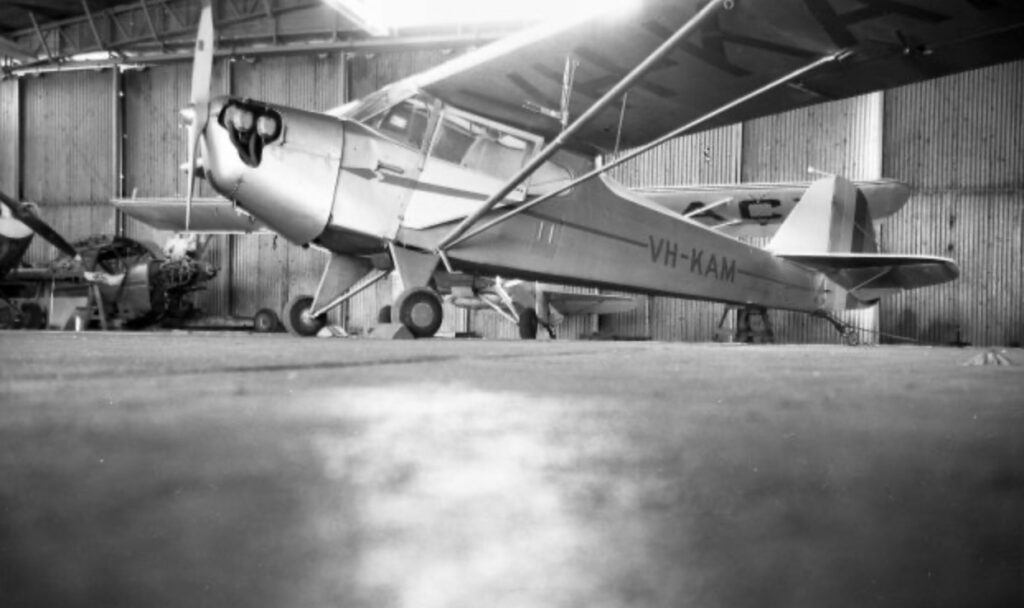
Witnesses at Happy Valley saw the tail plane about 50 yards offshore in the surf, half a mile north of Happy Valley. It is believed the plane came down in the surf well out from the beach and the strong south-easterly wind brought the craft towards the beach.
Walters survived but was unconscious and the aircraft was badly damaged. Walters was driven to Joe Cunningham’s logging camp at Bogimbah, which was the closest settlement with a phone. A plane was dispatched from Scarness to pick up Walters at the Bogimbah airstrip and an ambulance waited for him at Scarness. The plane was towed out of the surf by Joe Cunningham’s logging crew above the high water mark.
The conditions that day appeared deceptively benign with clear skies and good visibility. However, reports indicated strong south-easterly winds and significant surf conditions, capable of causing turbulence and wind shear, were to blame. A witness familiar with flying over the island commented on the range of landing options available, subtly highlighting that the issue was not a lack of space but the complexity of the environment in which the aircraft operated.
Orchid Beach, airstrips and the working aircraft
By the early 1970s, aviation had become a recognised part of Fraser Island tourism, but it would be a mistake to see it as limited to visitors and scenic flights alone. Behind the more obvious activity along the eastern beach, there was a parallel tale of aircraft being used as working tools in forestry and later in sand mining, where distance, terrain and time all imposed their own constraints.
Jules Tardent, a forester on the island during World War II, reported in his series of stories about Fraser Island published post-war in the Maryborough Chronicle, that there was an airstrip at Sandy Cape during the war. Not much is known about it at all and there is little, if any, evidence of it today.
The idea for the next airstrip on the island came about when Don Adams and Bill English, partners in a Cessna 172 high-wing monoplane, approached Forestry with a proposal to provide an aircraft passenger service to Fraser Island from Maryborough. Forestry agreed to build an airstrip south of Woongoolbver Creek and north of Panama Creek in 1960. On 17 November 1960, Adams landed his Cessna, VH-APK, on the airstrip. Island Airways was the first commercial plane to land on the island. Suddenly, it took only 12 minutes, not hours, to travel from Maryborough, a wonderful and vital asset for transporting accident victims in the notoriously dangerous forestry industry.
Another basic airstrip was established at Bogimbah (between Bogimbah and Poyungan Creeks). The airstrip was mainly used by logging contractors Andrew Postan and Joe Cunningham, who both built it in the 1960s after they got their pilot’s licence.
The same logic was applied during the sand mining era. Dillingham’s operations needed dependable access and the construction of Toby’s Airstrip offered a controlled point of entry and exit for staff and light freight. It was the best-built strip on the island at the south-east end of Pothole Road, to support their mining operations at nearby Third (or Taleerba) Creek. However, it still functioned as an airstrip in the Fraser Island manner, susceptible to sand, wind and maintenance issues that could not be completely engineered away.
There was a very small airstrip just south of Boomerang Lakes, called Darcys, after the pilot involved in the 1966 crash, Darcy Walters. The Northern Road, not far from the intersection with Happy Valley Road, now goes over the former airstrip.
Another small airstrip, called Coomboo, was built a mile north-east of the Coomboo Lake Forestry camp to transport and service workers staying at that northern, isolated camp.
On the eastern side in the isolated northern section, Orchid Beach developed as the island’s most recognisable aviation hub, with the rough strip there becoming closely associated with figures such as Don Adams and Reg Barnewall, whose efforts helped establish regular access by air. The strip allowed visitors to bypass the long overland journey and reinforced the idea, first floated in the 1930s, that Fraser Island could be reached as readily by air as by sea.
Moving men and supplies to and from the island could be slow and uncertain and aircraft provided a way to keep operations going. These strips, cut into the forest or cleared from the sand country, were not only functional but also marked an important change where aviation was no longer occasional but an integral part of operations.
Perhaps the clearest indication of how far aviation had penetrated island life, however, lies in the individuals who chose to learn to fly themselves. Logging contractors Andrew Postan and Joe Cunningham, along with tourism pioneer Sid Melksham, all took to the air as a practical extension of their work. For men operating between the mainland and the island, often under tight schedules, the aircraft was not a luxury but a necessity and another tool for overcoming distance and isolation.
Sid got the idea of flying when he saw Barnewall flying back and forth to the mainland and realised how much easier it would be for him to learn to fly rather than drive back to the mainland via Rainbow Beach. He spent every evening after work for the next six months teaching himself all the rules and regulations and he passed his flying exams first time. His first plane was a Cessna. When a cyclone arrived before he had time to take it to the mainland, he parked the plane on the grass just off the beach, tied down to a truck, while the sea came up all around it.
By the time Syd had acquired his fourth aircraft, a Beechcraft Duke, his commitment to aviation on the island had taken a more permanent turn. He leased the Wangoolbver airstrip and set about restoring it to a far higher standard than had previously existed, levelling and gravelling the surface to make it more reliable in all conditions. The Duke was a fast and capable aircraft, but one that demanded better than rough sand and to accommodate it Syd went a step further, having the Wangoolbver airstrip bitumen sealed so that it could be used without the risk of gravel damage to the aircraft’s nose. In time, this became the best landing strip on the island, used not only by Syd himself but by the Bundaberg air ambulance, visiting politicians’ aircraft and flying club excursions.
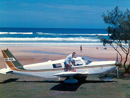
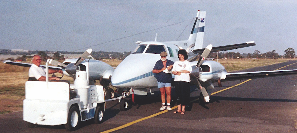
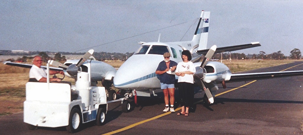
As predicted, aircraft also proved their worth in moments of genuine crisis. In the aftermath of the tragic July 1970 tourist bus accident, when the scale of the disaster demanded rapid medical evacuation and communication beyond what the island’s rough tracks and sea voyage could provide, aircraft became an essential part of the rescue effort. In that grim episode, the ability to move injured people and coordinate assistance quickly between Fraser Island and the mainland underscored a reality that had long been understood by those who lived and worked there, that on an island where distance, sand and isolation could turn every delay into a serious hazard, aviation was a lifeline.
Scenic flights
By the mid-1970s, aviation on Fraser Island had moved beyond necessity and into experience. The same beaches that had served as emergency landing grounds, working strips for forestry workers and miners and rough gateways for early tourism were now offering a view of the island that could not be matched from the ground.
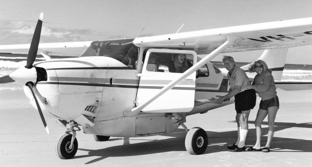
Among those who recognised that opportunity was Harry Geltch, a pilot from the New South Wales Central Coast who arrived on Fraser Island in the mid-1970s on what was meant to be a fishing charter. Like many before him, he found something about the island difficult to leave behind. After conducting a few joy flights from 75 Mile Beach, he made a decision that would shape a small but enduring part of the island’s tourism story. He relocated his operation, Harry’s Air Charter, to the Fraser Coast.
From that point on, the long sweep of 75 Mile Beach became not just a landing area but a departure point, where visitors could climb aboard a small aircraft and see Fraser Island as pilots had always seen it. The vast sand blows, the dark green spine of forest, the perched lakes set like mirrors among the dunes and the endless line of surf breaking along the eastern shore.
The Geltch family’s operations continue today, becoming part of the fabric of Fraser Island tourism, and, in doing so, they carry forward the same delicate balance that had always defined aviation on the island. These were not sealed runways or controlled environments, but beach operations timed to the tides, judged by the sand and shaped by the weather.
And, in Harry’s case, conducted with a certain irreverence. He was, by all accounts, a cheeky chappy, known to greet passengers with a small brush, carefully dusting the sand from their shoes before they climbed aboard. It was a practical gesture on a sandy airstrip, but also part of the theatre. Not everyone experienced it quite as expected. As one lady later remarked, with a mixture of surprise and amusement, “He brushed down my bottom too—but I hadn’t been sitting in the sand.”
Behind the humour, however, was something more enduring. Scenic flights built upon the earlier roles of aviation on Fraser Island. They turned necessity into a touristy experience and in doing so helped define how generations of visitors would come to understand the island, not just as a place to be explored on the ground, but as a landscape best appreciated in its full scale from the air.
What the modern record shows
Yet even within this more structured use of aviation, the same underlying reality persisted. Whether landing on the beach, a forestry strip, operating from Toby’s Airstrip, or arriving at Orchid Beach, pilots still worked in an environment shaped by natural forces rather than engineering certainty. The margins remained narrow and the consequences of misjudgement were never far away.
From 1986 onward, the Australian Transport Safety Bureau has provided a clearer and more systematic record of incidents on Fraser Island and what that record reveals is strikingly consistent.
In 1986, a Cessna 172 overshot the short, undulating strip at Orchid Beach in gusting crosswinds and ended up in trees adjacent to the strip and overturned. It was the end of a scenic flight and brumbies were on the strip, so the pilot decided to land long. As it touched down, the plane bounced and recovery action did not prevent further bounces.
In 1988, another Cessna was damaged when its nosewheel struck soft sand while taxiing on the beach at Eurong, damaging the propeller and one of the wings. It was midway between tides.
In 1989, a Piper PA-28 crashed shortly after a hasty take-off from Orchid Beach. An early turn and turbulent wind conditions were identified as contributing factors. The accident report stated that the pilot did not climb to a safe height before making a turn downwind in turbulent wind conditions. That same year, an amphibious Drifter crashed into the water near the resort after losing airspeed during its landing approach. The pilot indicated that he was winding down the landing gear as he flew parallel to the beach. This may have distracted him, allowing the airspeed to decrease.
In 1993, a helicopter on a night medical evacuation struck trees near Waddy Point after the weather deteriorated. En route, over the island, the helicopter was forced to descend to about 1,000 feet to remain below the clouds. As the helicopter approached the destination, it entered rain and the pilot commenced a descent. The rain became heavier and the pilot lost sight of all but one of the three light sources at the destination. He continued with the descent and decided that, because of the conditions, he would be unable to conduct a turn to clear the area.
The helicopter subsequently struck a tree and began to vibrate. After it struck another tree, the pilot closed the throttle and flared the helicopter, which came to rest upright about 400 metres prior to the threshold of the Orchid Beach airstrip. Clearly, there was pressure on the pilot to complete the evacuation despite heavy rain that moved in from the north and he continued the flight into non-visual conditions.
In 1994, another helicopter ended up in the water off the beach near the Maheno. The helicopter was chartered by the resort to take passengers to the wreck. The pilot stated that he was making an approach over the water to land on the beach to the north of the wreck when, at about 30 feet above sea level, he felt a “stiffness” in the cyclic control as he attempted to move it forward. Before he could assess the situation, the helicopter descended into the water. The aircraft remained upright and all the occupants evacuated and made their way to the shore. The helicopter was subsequently rolled onto its side by wave action and destroyed.
In 1995, a Cessna 205 encountered soft sand during a go-around and sustained substantial damage. Before landing, the pilot conducted his precautionary inspection of the landing area, noting several 4WD vehicles driving over it without leaving any indentations in the sand, indicating the surface was suitable for landing. As the plane slowed and the mainwheels touched down, the pilot noticed deep indentations and applied full power before the nosewheel touched down, initiating a go-around. However, the mainwheels encountered soft sand, slowing the speed and the nosewheel touched the soft sand and became embedded, bringing the aircraft to a sudden halt, causing the right wing to hit the ground.
Recent incidents follow similar patterns. In 2012, a Cessna 172 crashed during take-off at the beach after stalling in the climb, south of Yidney Rocks. The right wing tip struck the beach near the water’s edge and the aircraft came to rest on the left wing tip and nose. The waves later turned the plane on its back.
In 2019, a Gippsland GA8 Airvan experienced two separate landing gear failures on Fraser Island beach landing areas, and the safety investigation noted stresses caused by repeated operations in a salt-laden, sandy environment.
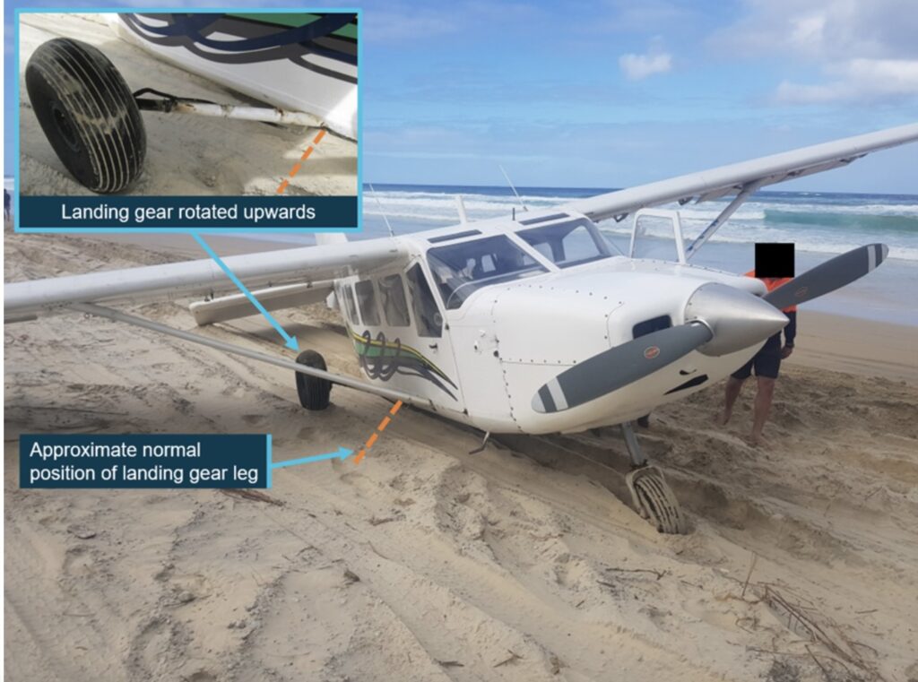
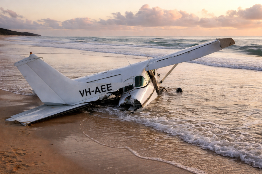
In 2020, another Airvan ran off a beach landing area after landing long and hitting a washout, while a Cessna 206 ended up in the water near Happy Valley following a loss of control during a training flight. Just after touching down, the aircraft veered significantly to the left, toward the sea. The training pilot took control of the aircraft and conducted a go-around. Once airborne, it was found that the rudder was jammed in the full left position and the pilot had to apply full opposite aileron to maintain control. The engine subsequently stopped and the aircraft collided with water. The two crew members had to swim 150 metres to shore, where they were met by emergency services and treated for minor injuries. The plane washed up on the shore later in the day.
In 2023, an Airvan lost its rear passenger door after taking off near Eurong on a short scenic flight. The pilot immediately flew toward the nearest landing area on the beach, north of Eurong and landed without incident. The pilot and passengers were not injured, but the door was not recovered.
Over more than 30 years of detailed investigation, the causes differ in specifics but not in essence. Soft sand, short or uneven landing spots, crosswinds, turbulence, obstacles and proximity to the ocean all keep recurring. None of these factors is unique to Fraser Island, but the way they come together and interact is.
The nature of the place
All of this points to something that early observers glimpsed but did not fully understand. Fraser Island’s beaches can serve as runways, but only under conditions that are both unpredictable and harsh. They are not built surfaces. They are ever-changing systems shaped by tide, wind and weather. What is firm in the morning may be soft by the afternoon, what looks level from the air might hide washouts or ruts and what feels like a manageable crosswind on approach could turn into turbulence at low altitude. And always, just beyond the edge of that visible runway, lies the sea.
Closing reflection
The history of aircraft on Fraser Island is therefore not a tale of disaster, but of cautious success. Aircraft have landed there safely for decades during wartime, in the early days of tourism and in modern times. But that success has always relied on good judgement, timing and reverence for the environment.
The beach that resembles a runway isn’t one. It’s something more ambiguous, more unpredictable and ultimately less forgiving. For those who grasped that Fraser Island was an opportunity, it was. For those who didn’t, it served as a lesson.
And the record of those lessons, scattered through reports, recollections and the occasional piece of twisted metal, remains part of the island’s quieter history, written not in headlines but in the fine line between what appears safe from above and what proves otherwise on the ground.
There’s no mention of Island Air & its operation at Orchid Beach. I attended a wedding at the resort in the late 70’s & was flown in by Island Air.
Another well written historical account on Fraser Island. That Coomboo airstrip was built in George Luke’s time on Fraser Island.
On my annual visit to Maryborough to see my grandparents, I was lucky enough to have a joy flight on the plane usually taking and picking up tourists, delivering milk, papers, and other supplies etc to Orchid Is Resort. It was just after very bad seas (vaguely recall it was a tidal wave) had destroyed the swimming pool built for the resort. Only half of the structure remained. It was never rebuilt. Think it was in the late 60s.
Years ago, I read a book about Reg Barnewell. It was all about his flying between the island and Hervey Bay. It was very interesting.
Another interesting part history of Fraser Island. Thank you Robert. The Queensland National Parks and Wildlife Service also chartered aircraft to land staff on the ocean beach near what was to become the Dundubara headquarters, with houses for staff being built when I joined the Department in 1978. On special occasions I flew to the island landing near Dundubara or at Orchid Beach. On this latter occasion I was investigating what became known as the Telecom Fire, started in 1983 by their staff. They had been cleaning out rubbish from their shed on radio hill and carelessly threw some insecticide cans onto the fire they lit for the occasion, where they exploded. These cans had been made specifically for Telecom. A combined task force of staff from QNPWS, Forestry and the local Rural Fire Brigade held the fire at the east-west ‘A’ Road.