
A history of burning, management and the illusion of control
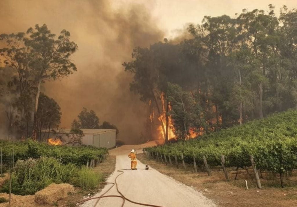
Spending time at Cudlee Creek in the Adelaide Hills over Christmas and New Year at the end of last year and beginning of this year, it’s impossible not to see the landscape through the lens of fire. The orchards, vineyards and tourist towns are real enough, but they sit lightly on a deeper, more enduring reality that the Adelaide Hills have always been a fire-prone landscape.
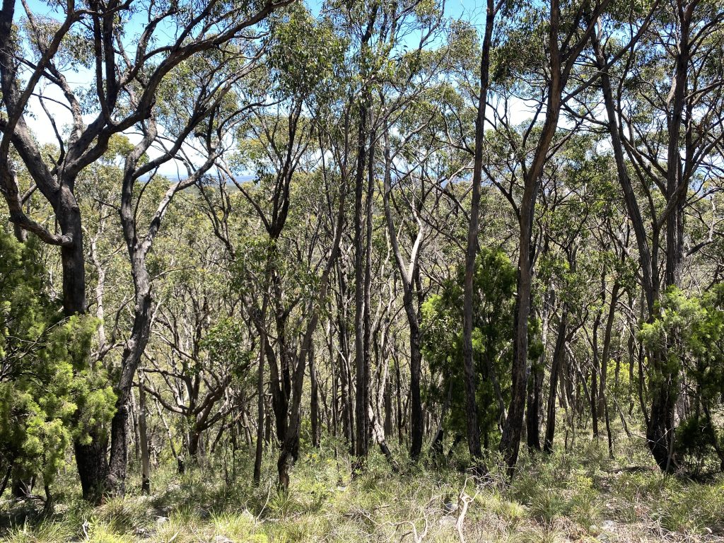
The scars remain visible long after the headlines fade. Around Fox Creek, the signs of severe fire are unmistakable. Dead trees, blackened trunks, fallen canopies, dense regrowth thickets packed tightly where mature forest once stood. This is not the result of low intensity burning that gently recycles a forest, but the signature of a crown fire capable of resetting entire hillsides in a single afternoon.
For those unfamiliar with fire behaviour, such scars and regrowth can seem like recovery. For those who have spent time managing land and fire, they serve as a warning.
The Adelaide Hills, like the Dandenong Ranges in Victoria, are a landscape where beauty and danger exist side by side, and where the consequences of misunderstanding fire are paid not in theory, but in houses, livelihoods and occasionally lives.
This essay traces the fire history of the Adelaide Hills not as a catalogue of disasters but as a story of how land use, population growth and changing management philosophies have progressively increased risk, often while emergency response leaders reassure the public that we are better prepared than ever.
That pattern of rising risk despite repeated warnings is not new. As early as 1972, a newspaper article in the Coromandel Times titled “Living Safely in Bushfire Areas” outlined, in plain language, many of the same principles that continue to emerge after every major fire. It identified fuel load as the dominant factor in fire intensity, argued that hazard reduction through controlled burning was essential despite the inconvenience of smoke and noted that houses are commonly lost after the central fire front has passed due to ember attack and nearby fuels.
These ideas were already well understood more than 50 years ago, yet many remain inadequately applied today.
Early burning in a lightly settled landscape
Fire existed in the Adelaide Hills long before European settlement. Aboriginal people used fire to shape vegetation and create access through the ranges for thousands of years. These fires were frequent and patchy. They helped reduce fuel, keep forests open and prevent extreme fire behaviour.
European settlement disrupted this regime almost immediately.
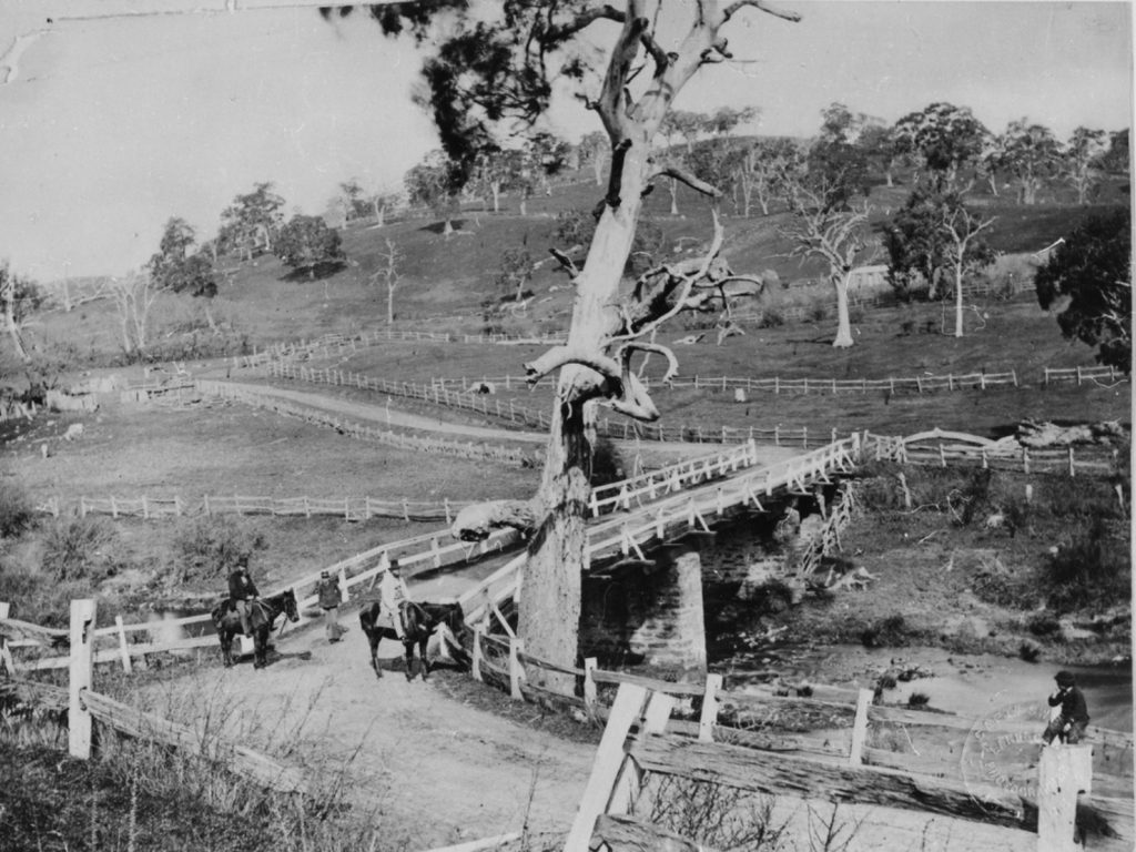
By the mid-19th century, land clearing for farming, timber harvesting and grazing began to alter vegetation and fire patterns. Early settlers often used fire in the hotter months to clear land, manage pastures and clear slash. Fires would often escape, but because settlements were sparse, these weren’t usually seen as disasters. Fires could spread widely without threatening many houses or property.
What is crucial here is that fire behaviour was not necessarily benign, but its consequences were mitigated by low population density and limited infrastructure in gradually declining forested landscapes.
The first recorded conflagrations
The first genuinely modern bushfire disaster in the Adelaide Hills happened in January 1939. An extended drought, high temperatures and strong winds caused multiple large fires that burned through the ranges for several days.
About 90 houses and many outbuildings were destroyed. The fact that no lives were lost is often used to suggest that the fires were less severe than later ones. This is misleading because the difference wasn’t in the fire itself, but in the extent of exposure.
These fires tore through forests, farms and small settlements when housing density was low, access tracks were few, but traffic was light, and protection expectations were modest. One firefighter described the Adelaide Hills as “everywhere black and cheerless” as firefighters battled in intense, suffocating heat.
These fires revealed the shortcomings of makeshift firefighting setups. They directly prompted the creation of more structured fire services in South Australia and laid the groundwork for organised bushfire management.
Following the fires, action was taken to prevent devastating bushfires. Despite the expected loss of men to the war, a detailed bushfire plan was prepared by the Metropolitan Councils’ Bushfire Organisation to primarily ensure there was a rapid mobilisation of trained firefighters at the onset of a fire.
When fire meets assets
However, the threats still persisted. Large stringybark trees along the unmanaged roadside reserves acted as wicks, facilitating the spread of fires through settled areas. Much of the land was owned by absentee speculators who did nothing to manage fuel or maintain firebreaks through dense patches of bush and blackberry.
On 2 January 1955, the Adelaide Hills again burned under extreme conditions. Known as Black Sunday, these fires were mainly caused by powerline failures during strong winds. This time, the damage was greater, with homes destroyed, significant forestry assets lost and the Governor’s summer residence at Marble Hill damaged. Sadly, two volunteer firefighters lost their lives.
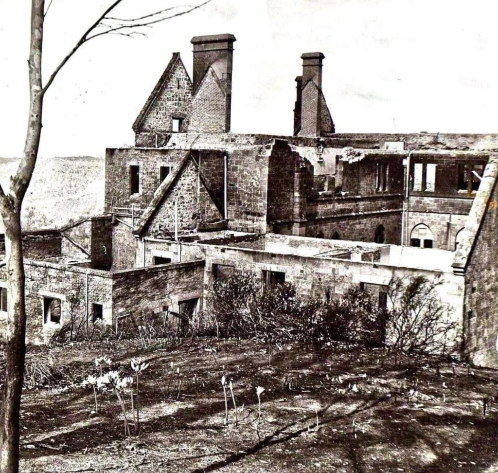
Black Sunday marked a turning point. The Hills were no longer a lightly settled hinterland. Development was speeding up and fire costs were rising, even though fatalities remained low.
Notably, this period coincided with the expansion of state forestry operations throughout the Hills. Although timber harvesting and grazing ceased by 1950, the steeper areas at Cudlee Creek and Coralinga were recognised as significant examples of remaining forest in the higher rainfall regions of the state and were managed as reserves.
Forestry as fire management
From the mid-20th century to the late 1980s, forestry workers played a key role in bushfire management in the Adelaide Hills. After the 1939 fires, which left the slopes overlooking Adelaide badly scorched and visually scarred, tree removal was necessary to deal with the damage.
The early years of the Woods and Forests Department focused on reacquiring previously forested land and planting Pinus radiata at a rate of 2,000 acres annually in the Adelaide Hills.
Forestry staff constructed and maintained extensive road and track networks, established and managed fuel breaks, carried out prescribed burns and mechanical fuel reduction and provided highly skilled ground crews during fire events.
These weren’t random contributions. Forestry workers knew fire behaviour inside out — not from manuals, but from daily contact with fuel, terrain and weather. They understood where fires would spread, where they could be stopped and where efforts would be futile.
For much of the twentieth century, bushfire management maintained a practical balance between year-round mitigation and seasonal suppression. Fires were fought during the summer, but preparations were made for them throughout the rest of the year. Forestry agencies invested continuously in maintaining roads, fire trails and fuel breaks, carrying out prescribed burning, training specialist crews and preparing the landscape before the fire season began. This preventative work greatly increased the likelihood that new ignitions could be contained before they escaped initial attack.
Over recent decades, however, that balance has progressively shifted towards emergency response at the expense of off-season land management. In its submission to the Independent Review into South Australia’s 2019–20 fire season, the Institute of Foresters of Australia observed that forest fire management had traditionally maintained an approximate balance between off-season wildfire mitigation and in-season suppression, but that resources had increasingly been redirected towards emergency response.
The gradual erosion of Forestry SA and other land-management agencies has not simply reduced staff numbers. It has diminished the State’s specialist capability in prescribed burning, remote-area firefighting, backburning and forest suppression. The Institute warned that the fire management resources of Forestry SA, DEW and SA Water had declined over the previous decade to the point where they were hindering South Australia’s overall wildfire suppression capability. It consequently called for additional year-round fire management staff to be recruited into these agencies.
That recommendation remains largely unfulfilled. The decline of forestry capability has reduced the number of people available to fight fires and weakened the year-round management of the landscape that once underpinned South Australia’s bushfire strategy.
1980: the forgotten precursor
Three years before Ash Wednesday, the Adelaide Hills once again burned under harsh conditions on 20 February 1980, in what became known locally as the Ash Wednesday I fires. Often overlooked in public memory, this fire destroyed more than 50 homes and damaged dozens of farms.
It should have been a final warning. The landscape, fuels and settlement patterns that would shape 1983 were already in place. Yet, the lessons were only partly learned, if at all.
The benchmark disaster
On 16 February 1983, the Adelaide Hills faced the most devastating bushfire event in their recorded history, which remains the benchmark catastrophic event in their fire history. More than 180 separate fires ignited across South Australia and Victoria on a day marked by record heat, extremely low humidity and gale-force winds. South Australia was declared a state of emergency for the first time.
These fires swept through forests and cleared the countryside alike. Approximately 383 houses and 200 other structures were destroyed in South Australia alone. Twenty-eight people lost their lives in South Australia, including 14 in the Adelaide Hills. Extensive areas of native forest and plantation were burned.
The Adelaide Hills were among the hardest-hit areas of the state, with fire spreading through vast forests and farmland and reaching towns as winds howled.
The fire that affected the Adelaide Hills started in outer-metropolitan Adelaide at about midday. It spread rapidly up Anstey Hill onto Paracombe. Crown fires quickly developed in native forest patches, which caused spot fires. At around 3 pm, the fire spotted across the Kangaroo Creek Reservoir and entered the steep plantations at Cudlee Creek. A wind change at 3:30 pm caused the eastern flank to spread into a wide front towards Gumeracha and Kersbrook, burning through a large section of the Mount Crawford plantations and destroying nearly 3,000 hectares of pine. Control efforts were virtually impossible in the extreme conditions and the massive dust storm that descended on the Mount Lofty Ranges didn’t help.
One person described the scene as:
The dark, orange, eerie smoke filled sky that engulfed the hills and surrounding areas for kilometres. The flames were visible from many kilometres away. An horrendous day.
The scale was historically unmatched. Extreme conditions paired with continuous fuel supply sparked a firestorm that even well-organised brigades couldn’t handle.
Ash Wednesday is often seen as an anomaly — a once-in-a-century event. This view is risky. It left a generation of fire managers determined never to see it happen again. However, the region’s vulnerability remained.
Ash Wednesday revealed the Adelaide Hills’ full potential when heavy fuels, severe weather and steep terrain combine. Fire behaviour surpassed the capacity of suppression systems under those conditions. Even experienced forestry crews, brigades and volunteers were overwhelmed by the intensity and rate of spread.
Forestry workers, brigades and volunteers fought with remarkable dedication, but they were overwhelmed.
After Ash Wednesday II: growth without restructuring risk
The decades following 1983 should have been a time for structural reform. Instead, they became a period of rapid development with minimal focus on bushfire threats.
Population growth in the Hills increased considerably. Housing extended further into forested slopes and gullies. Tourism infrastructure expanded. Vineyards and orchards spread into previously marginal land. Little planning was undertaken when subdivisions were approved, neglecting to consider adequate access for firefighters, the types of house construction materials and design, and the siting of dwellings in relation to bushfire risk.
This expanding urban–forest interface has changed how losses are understood. Whereas early fires mainly burned vegetation, later events have directly impacted property and livelihoods, even without fatalities.
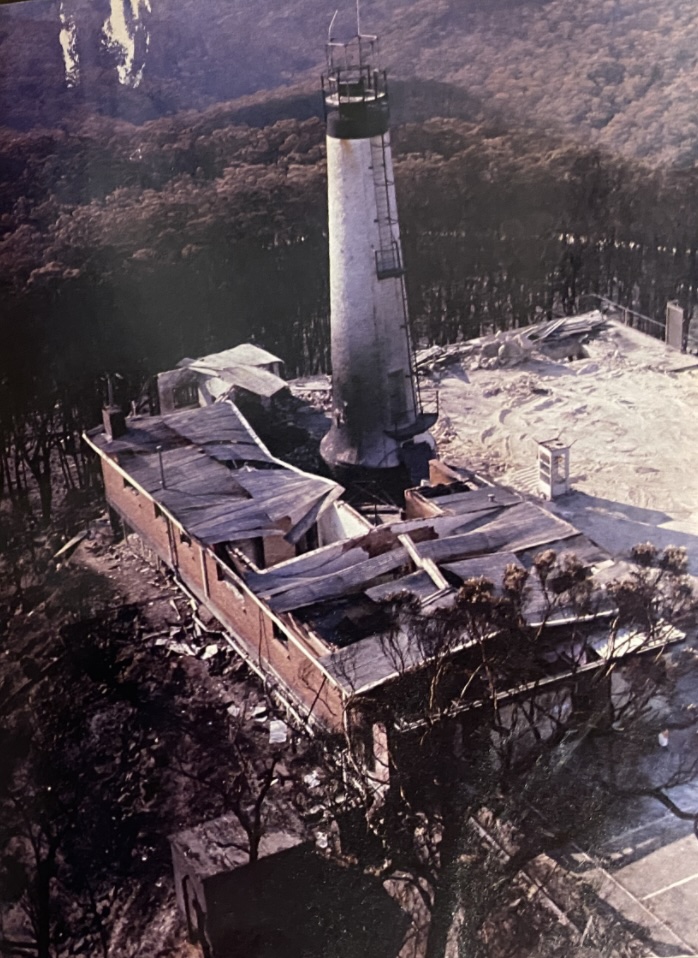
The Country Fire Service (CFS) made strong efforts to educate and prevent another Ash Wednesday event, but also urged landholders to take precautions against bushfires. Meanwhile, land managers of public land in the Hills did little to manage fuel levels outside the fire season.
At the same time, forestry operations were gradually scaled back, plantations were sold off and ground fuel management capacity diminished. The very workforce that had once quietly reduced risk was dismantled or significantly reduced.
These concerns were not limited to historians or land managers. In a detailed submission to the 2019-20 Natural Disasters Royal Commission, Professor Brendon Coventry, a surgeon and long-term Adelaide Hills resident with over 15 years’ experience in the CFS, presented a systematic critique of how bushfire risk was being actively built into Hills communities.
Coventry identified complacency, unchecked fuel buildup, fragmented regulation, poor coordination among agencies and unsafe escape routes as recurring and solvable causes of disaster. He explicitly warned that councils and governments were “designing firetraps” by allowing development in high-risk areas while failing to manage roadside fuels, enforce clearance standards, or secure effective evacuation routes. Notably, he emphasised that volunteer fire services cannot make up for impossible escape conditions or unmanaged landscapes, regardless of effort or bravery.
Fires without fatalities still matter
Between 1983 and 2015, many fires swept through the Adelaide Hills, causing considerable damage but few casualties. These events are important because they demonstrate how vulnerability increased even when a disaster was narrowly avoided.
In 2001, the local MP, Bob Such, voiced concern that many residents did not know what to do in the event of another major fire. Much of the bushfire safety information sent to residents was general and did not specifically address the Adelaide Hills, which faces a much higher bushfire risk than other parts of the state. Getting into a car at the last minute is risky, especially if the area is thick with smoke. For many residents, there was a sense of complacency towards the danger they faced, particularly since some areas had not experienced a major fire since 1956.
The material allowed for the option to evacuate or remain during a fire. However, the mass evacuation of 250,000 people from the area, with only three arterial roads, is very problematic once a major fire starts.
This wasn’t the only issue in the Adelaide Hills. Premier Mike Rann convened a Bushfire Summit in May 2003 after devastating fires in the eastern states the previous summer, where he urged that:
We must take a serious look at the issue of fuel in and around our parks before the next bushfire season…I’m not prepared to just let it sit there again for another season and hope that it doesn’t catch fire. That would be irresponsible.
Indeed, it was.
However, only about 30 hectares were burnt in the spring of that year in the Adelaide Hills, accounting for a mere 0.24 per cent of the region’s 12,156 hectares of bushland. No prescribed burning occurred in two of the most bushfire-prone parks – Morialta and Black Hill. The Environment Department Chief Executive, Allan Holmes, defended the small area, saying it was “strategic and carefully located”.
The Cherryville fire in mid-May 2013 occurred well outside the usual fire season, even when statutory fire bans had finished. A private burn-off escaped near Cherryville under warm weather, spreading into hard-to-reach forest and steep terrain, destroying a house and burning steep forested areas. It showed that fuel loads and access limitations were now enough to sustain dangerous fires even during moderate conditions.
The return of large fires
The Sampson Flat fire in early January 2015 burned over 12,600 hectares and destroyed 24 homes. Lightning and dry weather sparked multiple hotspots, which merged into a fast-moving fire complex that scorched public and private land across rugged terrain.
It affected several communities, harmed livestock and infrastructure and again exposed the limits of modern suppression.
Despite better coordination and resources, the fire’s spread was ultimately influenced by terrain, fuels and weather, not the number of aircraft. This fire demonstrated that, even with modern brigades and fire planning, large fires in extreme weather can still cause significant damage to settlements and the economy in the Hills.
The most recent major fire, on 20 December 2019, is still clearly visible across the landscape today. Around Fox Creek, the damage remains recent. The fire started at Cudlee Creek in the mid-morning and quickly spread to Lobethal, Woodside and other Hills communities amid severe weather. More than 2,000 volunteer firefighters responded, and the main fire was controlled after 24 hours, but flare-ups lasted for over 10 days.
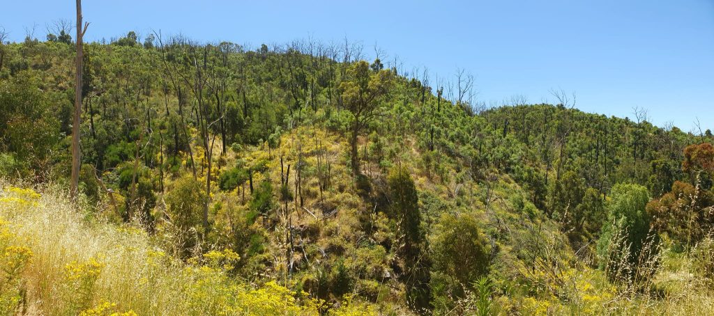
More than 23,300 hectares were burned, including 60 per cent of the forest estate. Around 85 homes were lost and one life was taken. The severe fire swept through plantations, native forest and interface areas.
Despite thousands of firefighters and extensive aerial support, the fire escaped early control. Containment improved as the weather moderated, as it always does.
This fire clearly showed that, even with helicopters and aircraft available, fires can rapidly grow beyond initial efforts under severe weather, especially in the steep, fuel-laden terrain around Fox Creek.
The regeneration trap
The aftermath of these fires has formed a new, deeply troubling landscape we observe today.
Severe crown fires create dense, even-aged regrowth, heavy fine fuels and continuous ladder-fuel structures. These forests have become more flammable over the decades. Prescribed burning becomes more difficult, mechanical treatments more costly, social resistance increases and fuel age mosaics break down into uniform risk.
The risk of unchecked fuel buildup was well understood long before the modern fire era. The 1972 article warned that unmanaged vegetation near homes and along access routes created conditions where fires could spread quickly and become uncontrollable. Coventry was especially critical of roadside fuel accumulation, noting that roads once acted as informal firebreaks and evacuation routes, but had become increasingly hazardous due to dense vegetation and flammable plantings. He argued that neglecting to maintain these corridors turned evacuation from a safety measure into a liability — a point repeatedly reinforced during later fires in the Hills.
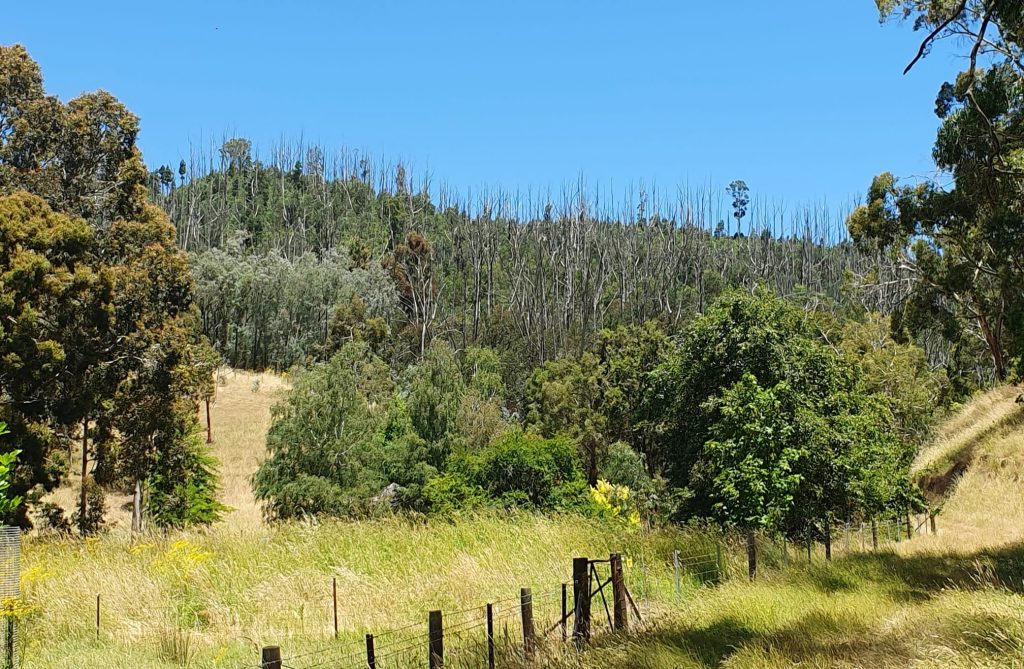
What has changed since then is not the fire behaviour, but the scale and continuity of fuels and the way successive high-intensity fires now pre-empt and disrupt planned fuel reduction programs before they can be carried out.
Prescribed burns were planned for Coralinga Native Forest, but the Cherryville fire occurred before they could be conducted. Since the fire burned through most of the reserve, there were no immediate plans to carry out prescribed burning. The short-term plan became long-term when the area was affected again in 2019.
The current management plan does not mention carrying out any prescribed burning.
The illusion of aerial supremacy
The limitations of aerial firefighting are evident from recent experiences. During the 2019 Cudlee Creek fire, extensive aerial resources were deployed as the fire moved through steep, fuel-rich terrain toward Lobethal and nearby communities. Despite persistent aircraft activity, the fire escaped early containment, spread through plantations and native forest, and was only brought under control after weather conditions improved. The outcome was shaped not by the number of aircraft overhead, but by fuel continuity, terrain and fire weather. This pattern has repeated itself across the Hills.
Modern bushfire suppression increasingly relies on the idea that aerial firefighting — water bombers, helicopters, large air tankers, and very large air tankers — can put out major forest fires. This belief is common, politically easy and seriously misleading.
Experience in Australia, the United States and Canada shows that no serious forest fire has ever been fully stopped by water or retardant dropped from aircraft. In good conditions, aircraft can slow a fire’s spread, suppress spot fires and temporarily reduce flame height. They can also hold a small or moderate fire long enough for ground crews to arrive.
However, they cannot build containment lines, mop up, hold a live-fire edge, or operate in many of the conditions under which the most destructive bushfires occur.
Aircraft cannot fly safely at night, in high winds, or during electrical storms — conditions that often coincide with major fire events. Drops made in steep terrain, gorge bottoms, or beneath heavy timber are often ineffective. Retardant and water do not remove fuel. They only temporarily dampen it. Once that moisture evaporates, fire behaviour resumes, often within minutes.
These limitations are not new insights. The use of aircraft to drop liquids on bushfires began experimentally in the early 1920s, but little progress was made until the mid-1950s, when forest services recruited experienced agricultural pilots skilled in low-level flying. By the late 1950s, enough operational experience had been gathered to allow a sober assessment. A 1958 report in the Bush Fire Bulletin, reviewing United States Forest Service experience with air tankers carrying between 300 and 5,700 litres, concluded that aircraft could assist ground forces in very specific ways, but only in limited circumstances.
That experience demonstrated that air tankers could contain a small fire until the initial ground attack arrived, knock down spot fires and cool hot spots. It also showed they could not suppress rolling brush or timber fires, operate safely in high winds, make effective drops in steep gullies, cool intense fires in heavy fuels beneath forest canopies, or operate at night.
Nearly two decades later, in 1975, Bob Richmond of the New South Wales Forestry Commission revisited the issue, drawing on extensive North American experience. His conclusions remain strikingly relevant today. Richmond observed that air attack was primarily designed for early initial attack on small fires, where it could be highly effective, particularly in inaccessible terrain. However, he warned that aircraft were increasingly being used as a “desperation tactic” on large fires, precisely the situations in which they are least effective and most dangerous.
Richmond noted that although air attack might be used on only 10 to 15 per cent of fires, it could consume up to 40 per cent of fire protection budgets. He also warned that the most dramatic and widely publicised aircraft uses tend to occur during large, uncontrollable fires, creating a false impression of effectiveness while putting pilots at unacceptable risk.
Despite this long-standing knowledge, the same pattern now prevails in the centralised, modern emergency response model to fighting fires.
During the 2019–20 fire season, the New South Wales Rural Fire Service spent about $255 million on aircraft hire, which was over a quarter of its total spending. Large and very large air tankers reportedly conducted over 1,700 missions and released more than 24 million litres of suppressant. On average, around 100 aircraft operated daily across New South Wales firegrounds.
Yet there has been no thorough cost–benefit assessment of what this aerial fleet truly achieved in terms of fire containment or area saved. The Gospers Mountain fire alone burnt over 512,000 hectares of mostly “wilderness” and World Heritage Forest. How many of those thousands of drops significantly affected the final outcome remains unknown.
What is most concerning is how aerial firefighting has begun to replace, rather than support, strategic ground-based fire management. Before 4 January 2020, permission to carry out backburning along the Princes Highway during the Victorian-New South Wales Border Fire was refused because authorities did not want “any more fire in the landscape.” As a result, the Border Fire ultimately burned an extra 191,000 hectares. A complete ban on backburning was maintained even while active fires burned behind nominal containment lines, potentially putting communities and forests at greater risk of blow-up events until rainfall came weeks later.
This raises a fundamental question: what is the purpose of maintaining extensive aerial resources if they are not utilised to support strategic backburning, containment and edge consolidation during periods of relatively benign weather opportunities between extreme fire weather events?
The uncomfortable truth is that aerial firefighting has become more about reassurance. They are highly visible, politically defensible, and media-friendly, while the more challenging, riskier, and less glamorous tasks, such as fuel reduction, ground access and tactical fire use, have diminished.
A further consequence of this shift is the erosion of operational doctrine within emergency control structures. Many senior fire managers now operate primarily from emergency coordination centres rather than from long-term engagement with forested landscapes, and the institutional knowledge once embedded within state forestry agencies has been progressively lost. The result is a diminished capacity, or willingness, to employ proven firefighting strategies developed over decades, which combined meticulous off-season preparation of firebreaks and fuel management with intensive surveillance during the fire season and rapid, decisive ground attack using personnel and machinery to contain fires while they were still small, even under severe fire weather conditions. Under this approach, dependence on expensive aerial support was significantly reduced.
The ideology behind this shift is also problematic. It includes the idea that prescribed burning is unnecessary because “nature will look after itself,” or that long-unburnt forests eventually become non-flammable. No such condition has ever been observed in any eucalypt forest in Australia. Forests left unburnt for many decades still gather large fuel loads and remain capable of supporting high-intensity fires.
Airborne firefighting may seem decisive and it photographs well. But for anyone or anything in the path of an out-of-control fire, it provides little protection and often arrives too late, or not at all. The best hope is that such fires eventually meet recently treated landscapes where fire behaviour is lessened. This outcome has been repeatedly proven and no aircraft can replace it.
Living with the consequences
Our brief stay at Cudlee Creek showed us that this history is not just theoretical. It is evident in the regrowth, the slopes, the access restrictions and the proximity of houses to the forest. A visit to the Mount Lofty Botanical Gardens and the walk up to the Mount Lofty summit above Adelaide made this reality even clearer.
Within the Gardens themselves, there are stands of tall Eucalyptus obliqua forest — tall, at least by South Australian standards — supporting a dense shrub understorey that has clearly replaced what was once a more open, grassy forest floor. Signage explains that prescribed burning was used as a management tool, with photographs showing burns carried out in 2009 and 2011. What is striking, however, is not the presence of these signs, but the absence of any evidence of subsequent burning. The understorey across large sections of the slope is now dense, continuous and becoming structurally connected to the canopy.
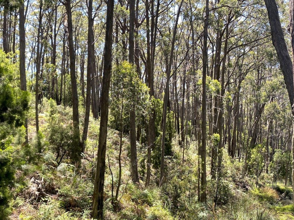
When asked about fuel management, a staff member said the remnant forest is managed on a 7-year cycle. That might be the goal, but it’s not obvious on the ground. The whole forest we walked through showed continuous fuel growth, with no clear breaks, no recent low-intensity treatments and no visible division into manageable burning units. Whatever the planning documents state, the fuel structure tells a different story.
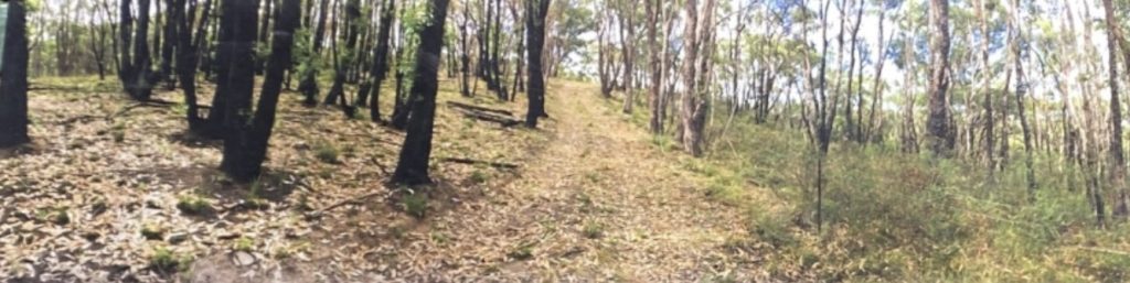
The walk beyond the Gardens towards the Mount Lofty summit at Crafers passes houses perched directly above Adelaide on steep, west-facing slopes. These dwellings back onto fully vegetated bushland almost immediately. In some areas, a narrow buffer of about 20 metres has been cleared or thinned between the houses and the forest. On a mild day, this looks reassuring. On a severe fire weather day, it would be meaningless.
A crown fire starting low on that slope, driven by hot northerlies and preheated by the incline, would not pause at a 20-metre fuel-reduced strip. Ember attack, radiant heat and direct flame contact would easily overwhelm such a buffer. The protection offered is mainly symbolic rather than practical.
What makes this confronting is not just the exposure of individual houses but the wider contradiction it reveals. Residents in these areas are often told to prepare by clearing gutters, maintaining defensible spaces and having a fire plan ready. However, the large stretches of public land around them, which ultimately influence fire behaviour, remain heavily fuelled, difficult to access and mostly untreated.
This risk is compounded by current planning practices in rapidly expanding parts of the Adelaide Hills, especially around Mount Barker and the southern Hills. In these regions, dense housing developments have been approved in landscapes with few escape routes, while councils also enforce strict tree preservation orders that greatly limit the removal of vegetation near homes. The emphasis on keeping trees and dense plantings close to dwellings may meet aesthetic and environmental goals under normal conditions, but it is unsuitable in a highly fire-prone environment with severe fire weather. When combined with narrow roads and limited evacuation options, the model of closely packed housing amidst unmanaged vegetation presents a level of risk that cannot be reduced solely through individual household measures.
The imbalance is stark. Responsibility is passed down to individuals, while proper fuel management on public land is often delayed, dodged, or explained away through bureaucratic processes. The outcome is a community living in one of the most fire-prone regions in the state, reassured by plans and signage, but surrounded by fuels that make those plans pointless under the very conditions that matter most.
The Adelaide Hills are not under-protected because firefighters lack courage or equipment. They are under-protected because risk has been allowed to build up through land use, the absence of fuel management decisions and ongoing housing development at a pace faster than we can manage.
History is not comforting
The fire history of the Adelaide Hills reveals a consistent pattern that shows fire is unavoidable and its severity is on the rise. Suppression alone cannot offset unmanaged fuel loads and growing exposure.
We have known this since 1939, were reminded in 1955, were shown unmistakably in 1983 and we have confirmed it time and again since.
Coventry’s submission concluded that bushfire risk is being perpetuated not by lack of knowledge, but by fragmented governance, with overlapping local, state and federal responsibilities creating inertia where decisive action is needed. That diagnosis remains uncomfortably accurate today.
Ignoring that history doesn’t make the Adelaide Hills safer.
Another great analysis of the problems that lie beneath 21st fire management in Australia. Whenever the heads of fire management agencies and other alleged experts promote aerial fire assets as the key element in modern fire management and response, one photo springs to mind. It was published in the Melbourne Herald Sun and shows a commercial air liner with a backdrop of the Black Saturday Kinglake smoke cloud. Black Saturday was the day Dr Kevin Tolhurst wrote in his report to the Victorian Royal Commission:
“The total amount of heat released from the fires on “Black Saturday” would have been sufficient to provide the total energy needs for all Victorian domestic and industrial use for a year. This energy was released in just a few hours. The energy of the fires was equivalent to more than 1500 atomic bombs the size of the one used at Hiroshima, which devastated an area equivalent to 2,000 ha, but bushfires release their energy in a “storm” not a “blast”. This gives an indication of the destructive power of these fires.”
Who would ever think that enough aircraft could be deployed to contain one Hiroshima atomic bomb in a day, let alone 1,500? But we have ex-spurts in the country providing advice and influence who don’t get the physics and insist on putting all our eggs in the emergency response basket. I can send you a copy of the photo if you have not seen it.
The politicians and senior bureaucrats love the concept of aircraft as firefighters. Big, noisy, expensive, sometimes they do a great job, and it makes a superb 30 second news clip, demostrating what a great job the government is doing keeping communities safe in the face of increasing disasters, because of climate change. The trouble is, as superbly explained above, it’s mostly bullshit.
Fire danger is reduced, and sometimes fires are beaten during autumn and spring, in nice weather.
The issues in NSW are virtually identical to those described above. Environmental activists with no real-world knowledge occupy positions where they can cause immeasurable harm by failing to conduct controlled burns, clearing, and general bush management.
There was one such individual on local shire staff here who absolutely refused to remove dead & dangerous trees beside roads. It wasn’t his fault, according to him. It was the state-level legislation that all councils had to operate within. But it seems odd to me and others that everything has to be made safe, to the point of extreme ridiculousness, but roadsides are left in a very obviously dangerous state because of “habitat”.
The pine plantations are the biggest threat in the areas they infest. There is no management to speak of once established, because the regulation that the people in the pine industry wrote doesn’t require it. Its an extremely dangerous disgrace, and its allowed to continue because of political cowardice, stupidity and greed.
The plantations are heavily involved in the “renewable” scam and carbon madness.
A well written essay, Robert. This highlights what happens when fire management becomes politicised and used as a political tool.
Robert, once again, I’ll beat the same drum: aerial attack is not firefighting. It is a limited suppression tool that must be used strategically and at the right time.
Unfortunately, the overreliance on this overrated resource creates great photo opportunities while allowing managers and politicians to avoid responsibility for planning and mitigation.
The public has come to believe that if aircraft aren’t visible, not enough is being done. As I’ve said before, this was a consistent message I and others heard from visiting American fire experts from Missoula in the 1990s.