Introduction
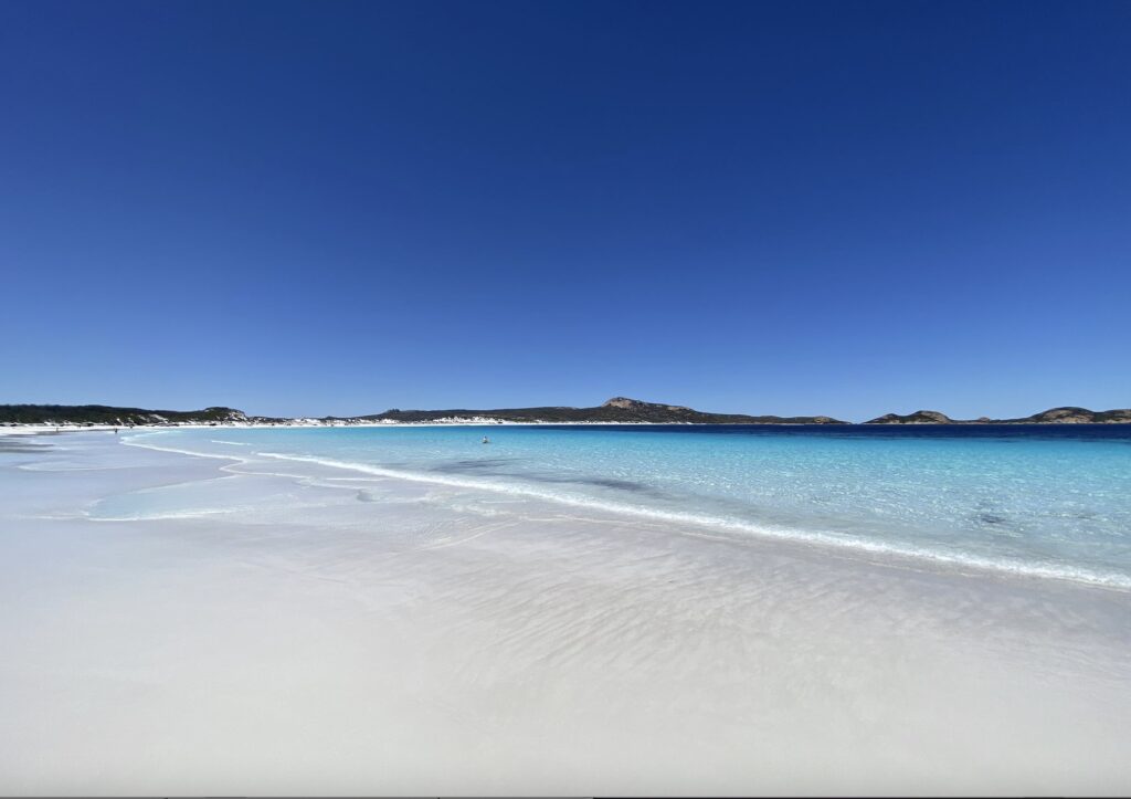
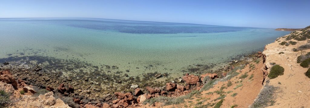
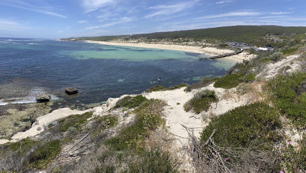
I found the coastline of Western Australia so different to places at equal latitude on the east coast. There are rocky islands and ledges that protect the coast from the incoming swells, tropical fringing reefs and vast meadows of seagrass. There is a tropical feel to the waters so far south. The main driver for this is the Leeuwin Current, which most people have probably heard of. But how much do they know about this extraordinary phenomenon?
Ocean currents are the continuous, predictable, directional movement of sea water horizontally driven by several forces acting on the water including gravity, wind, and water density. The paths they follow is akin to the way rivers flow on its set path.
Australia is influenced by four major ocean currents. The “East Australian Current” is southward flowing from near Fraser Island to Tasmania. The “Indonesian Through Flow” is a system of westward flowing currents from the Pacific to the Indian Ocean. The “Antarctic Circumpolar Current” is the world’s largest ocean current and a powerhouse for global climate. And finally, the Leeuwin Current.
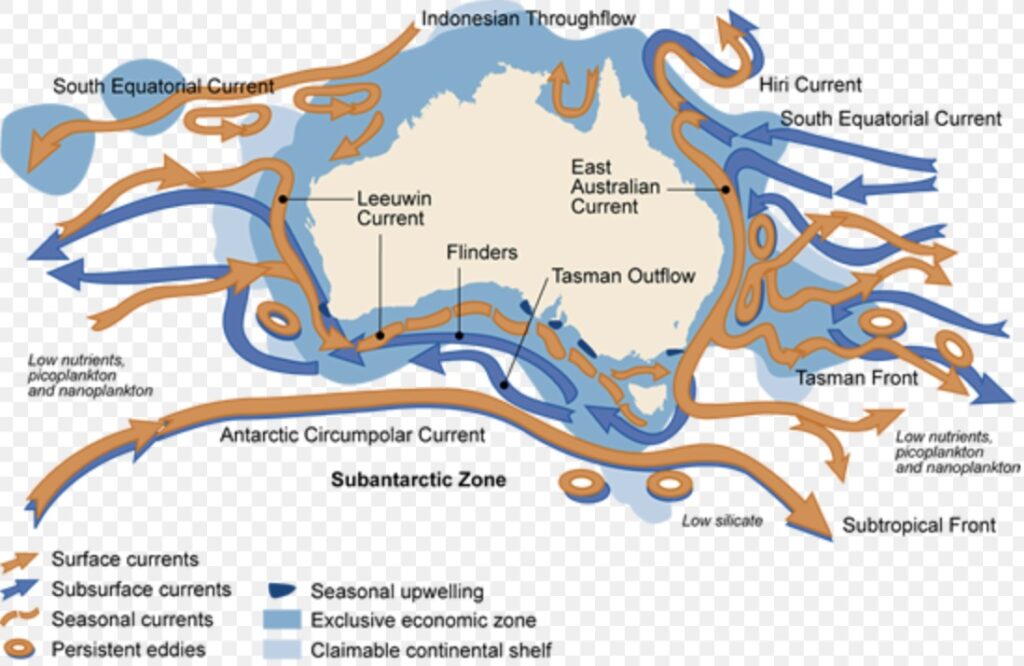
The water temperature off the Western Australian coast is influenced by the Leeuwin Current, which flows south along the coast from Indonesia. It originates near the North West Cape in Western Australia and flows southward towards Cape Leeuwin before turning eastwards into the Great Australian Bight on towards Tasmania.
Why does it occur?
It occurs because of the “gap” between Australia and Indonesia that connects the Pacific and Indian Ocean. The easterly winds over the Pacific Ocean pile warm water up on the western side of the ocean basin. This increases the sea level through the Indonesian archipelago. The high sea level signal is then transferred down the coast of Western Australia, creating pressure gradients that draw in warm water and push it southward, forming the Leeuwin Current.
The easterly winds over the Pacific Ocean vary over time, being stronger in La Nina years and weaker in El Nino. The changing wind strength alters the amount of water piled up in the west of the Pacific and hence the sea level near Indonesia – higher in La Nina years and lower in El Nino. The changing level then influences the strength of the Leeuwin Current.
The unique features of the Leeuwin Current
The Leeuwin Current is unique in the world as it is the only subtropical poleward-flowing boundary current on the eastern side of an ocean basin. And at 5,500 kilometres, it is the world’s longest continuous ocean coastal current.
Most coastal currents, such as the East Australian Current and the Gulf Stream, are found on the western side of ocean basins.
The Leeuwin Current is unlike other currents that run on the west coasts of Southern Africa and South America, large land masses at similar latitude. In the Atlantic and Pacific Oceans, strong currents from the Southern Ocean carry cold water along the west coast of Africa and South America. The cold current allows water from the ocean floor to rush to the surface, carrying nutrients. These nutrients nourish the ocean plants called phytoplankton that form the base for the marine food chain. This creates very productive fisheries, teaming with life. On the other hand, the Leeuwin Current is warm, and keeps the denser cool water from rising. This means the waters off Western Australia are up to four degrees Celsius warmer than those at corresponding latitudes off the west coast of Africa and South America, and relatively poor in nutrients. However, the warm waters allow tropical plants and animals to survive much further south, hence that tropical “feel”.
There are two main unusual features about the Leeuwin Current which are interconnected. The first is that it flows directly into the wind carrying warm water southwards transporting warm and nutrient poor water from the tropics, which allows tropical species to penetrate further south than another place in the world.
Secondly there is a strong heat loss which creates the third unusual feature – deep mixed layers. And it is the deep layers that are essential to the maintenance of a large alongshore pressure gradient.
So in essence, warm waters flow downhill to the south overcoming the efforts of the wind to push them northward. The wind is less effective in moving deep surface mixed layer than a shallow one.
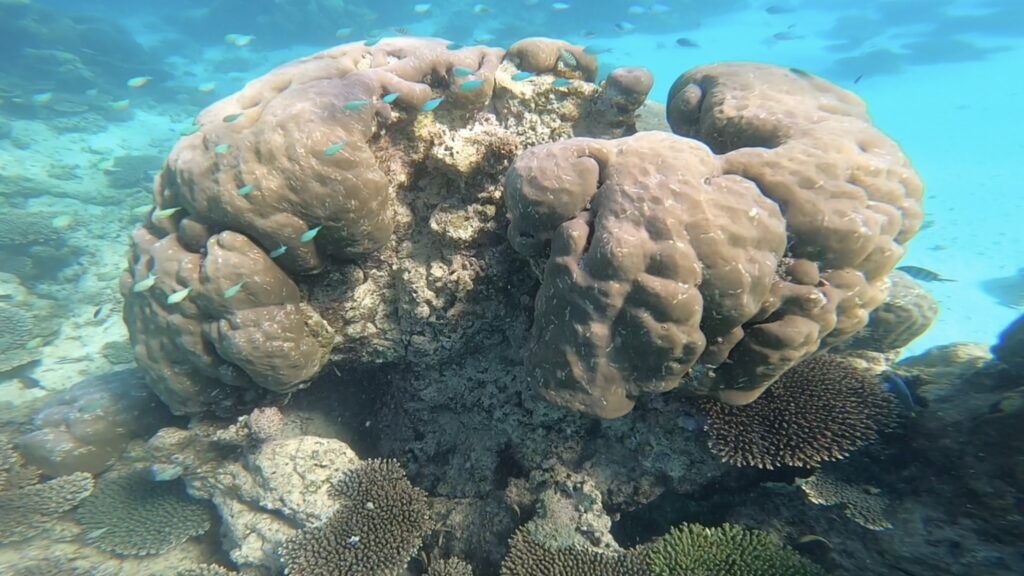
The coral reefs off the Western Australian coast occur over an extremely large latitudinal gradient of several thousand kilometres from the tidal-dominated tropical reefs of the Kimberley region to the temperate sub-tropical reefs of the Houtman-Abrolhos Islands and marginal reefs offshore from Perth.
The marine waters from Shark Bay to the South Australian border contain the most extensive seagrass meadows and the world’s largest population of dugongs.
The Western Australian reefs are renowned for the abundance of unique and iconic fauna they host, in stark contrast to the red deserts on the adjoining land.
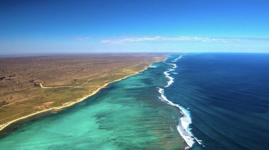
Another major influence on the marine environment of Western Australia are regular severe cyclones. Much of Western Australia is arid and this means low level of freshwater runoff, except for the far north Kimberley coast with its big wet season outflow. Big westerly swells means that the coastline is often blasted with high wave energy.
The southern half of Western Australia’s coastline provides ideal conditions for seagrasses – clear waters, low nutrients, protection from heavy seas and swells, and sandy substrate. There are extensive meadows of seagrass found in Shark Bay, Geographe Bay, Flinders Bay and along the southern coast. In the northern half, seagrass abundance is lower because of the large tidal movements, higher turbidity, and large seasonal freshwater run-off.
So next time you enjoy the Western Australian coast from the Kimberley, through to Shark Bay and the southern coast as far east as Esperance, not only will you enjoy relatively warmer water, but take note of clues that give it a more tropical feel.